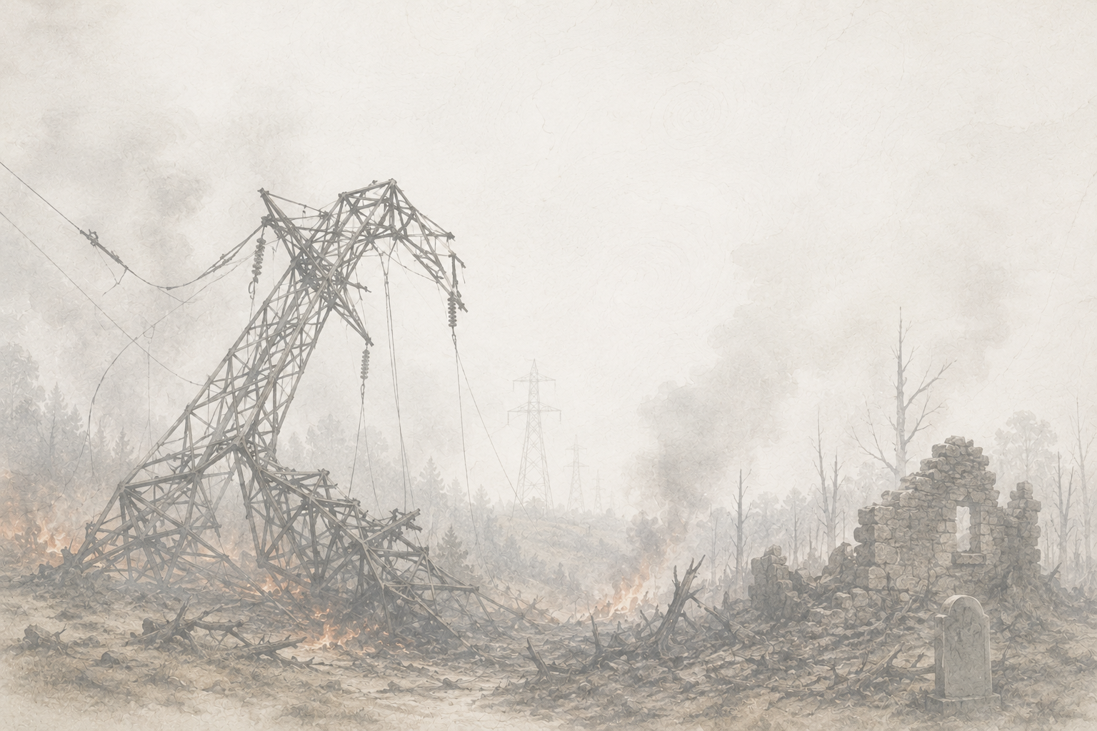
Siting Constraints and Technical Hazards - The Perfect Storm
A complete decimating loop of destruction proposed by Valley Link - The Plan for Barbour County
Starting with the Tygart River and then on to an undisclosed gas compressor, 6 origin mountain springs feeding sugar creek, which feeds back into the Tygart, an aquifer at risk, a chestnut orchard decimated by negligent engineers using outdated material from PATH.
There is a difference between “public necessity” and “public harm”
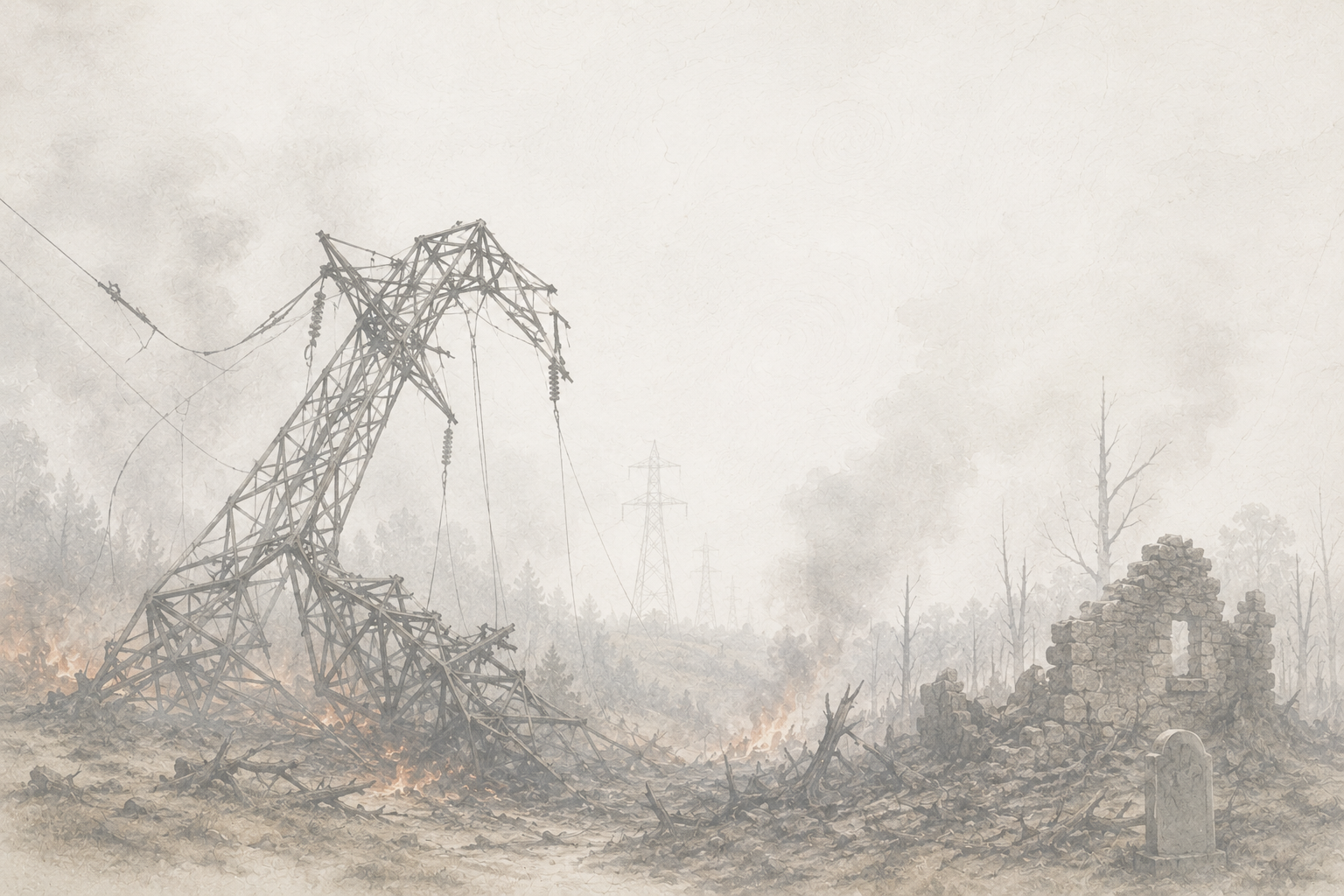
The Tygart Valley River: A Vital Resource for Barbour County
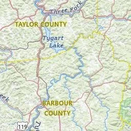
The Tygart Valley River is one of Barbour County's most important natural resources. Flowing through Barbour County before continuing into Tygart Lake and Taylor County, it supports agriculture, wildlife, recreation, tourism, and local communities while serving as the primary watershed for much of the region. Numerous streams, springs, and tributaries throughout Barbour County ultimately drain into the Tygart, making the health of its headwaters essential to the health of the river itself. Many fish species within both the Tygart Valley River and Tygart Lake are dependent upon suitable water temperatures and healthy aquatic habitat for survival.
Healthy headwater streams provide far more than flowing water. They regulate water temperature, reduce streambank erosion, transport nutrients, filter sediment before it reaches larger waterways, sustain aquatic insects that form the foundation of the freshwater food chain, and provide critical spawning and nursery habitat for fish and other aquatic species. These small mountain streams are the foundation of the entire watershed, supporting not only the ecological health of the Tygart Valley River but also the farms, communities, and natural resources that depend upon it.
What Happens When a 765-kV Transmission Corridor Crosses a River?
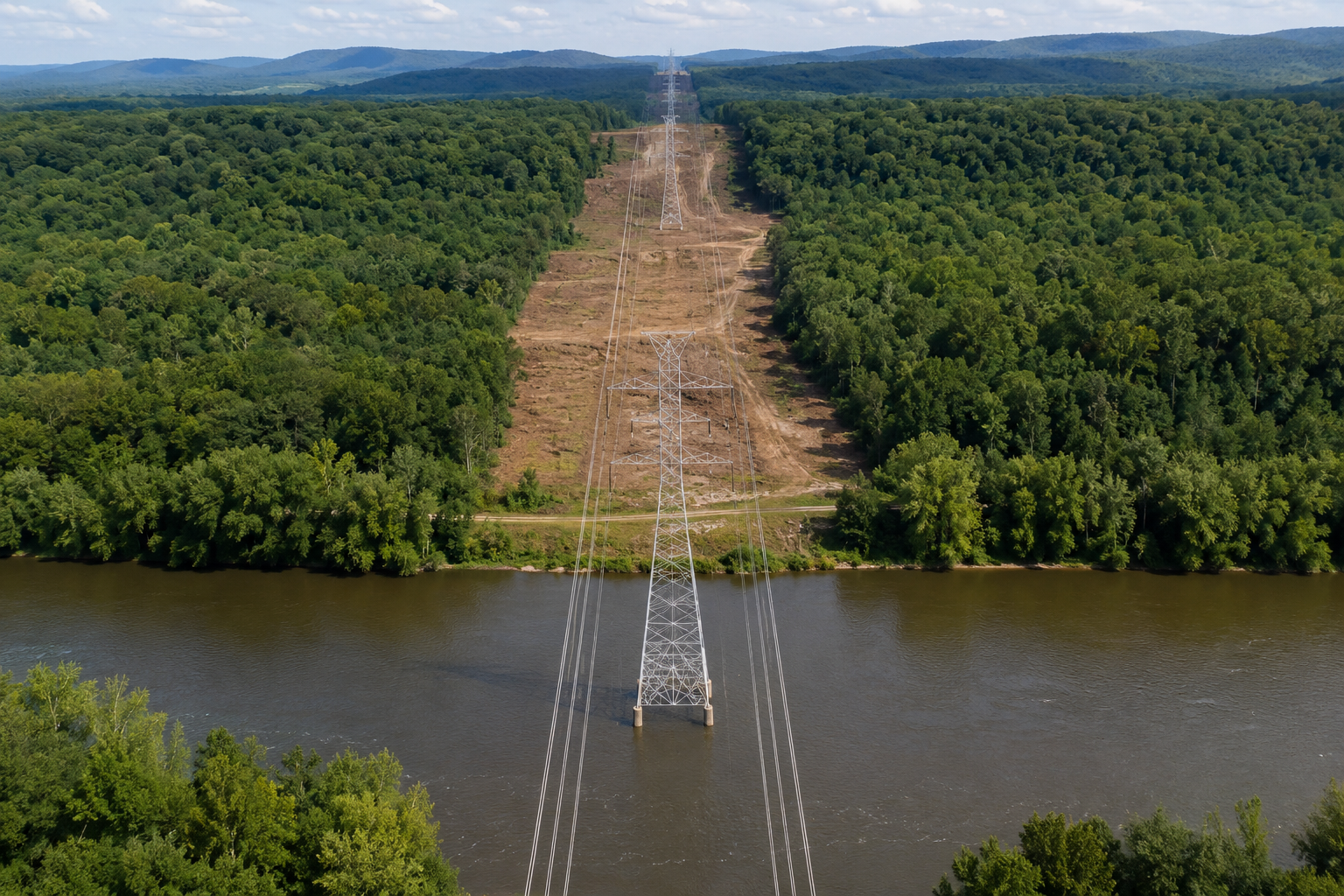
An overhead 765-kV transmission line does not directly radiate enough heat to warm the water beneath it. Although electricity flowing through the conductors generates heat due to electrical resistance, the distance between the transmission lines and the river prevents that heat from transferring directly to the water.
The concern instead lies in the construction, clearing, and long-term maintenance of the transmission corridor itself.
To construct and maintain a 765-kV transmission line, utility companies must establish a wide right-of-way by removing tall trees and vegetation where the corridor crosses rivers and streams. This permanently alters the riparian forest that naturally protects the waterway.
Potential impacts include:
Loss of Riparian Canopy: Removing trees eliminates the natural shade that helps regulate stream and river temperatures. Increased sunlight can warm localized sections of the water during the hottest months of the year, particularly in smaller streams and tributaries.
Warmer Stormwater Runoff: Cleared rights-of-way contain less vegetation to absorb rainfall. During summer months, exposed soils, construction areas, and access roads absorb heat, causing stormwater runoff entering nearby waterways to be warmer than runoff from intact forested areas.
Soil Disturbance and Sedimentation: Construction activities, grading, heavy equipment, and access roads disturb soils and increase erosion potential. Sediment entering rivers and streams can reduce water quality, smother spawning habitat, cover streambed gravels, and degrade aquatic habitat.
Streambank Destabilization: Disturbance of vegetation and soils near waterways can increase long-term bank erosion, alter stream morphology, and increase sediment transport downstream.
Habitat Fragmentation: Clearing wide corridors through riparian forests fragments wildlife habitat and can reduce connectivity for terrestrial species that depend upon continuous forest cover.
Changes in Stormwater Hydrology: Permanent access roads, vegetation management, and altered drainage patterns can affect runoff rates, stream flow, and sediment movement throughout the watershed.
These effects extend far beyond the immediate river crossing. Many aquatic plants, insects, amphibians, mussels, and fish are dependent upon relatively stable water temperatures, clean streambeds, and healthy dissolved oxygen levels. Even localized warming, increased sedimentation, or reduced stream shading can alter the composition of aquatic insect communities that form the foundation of the freshwater food web.
When those insects decline, the effects move up the food chain. Fish, amphibians, reptiles, birds, bats, and mammals that rely on those organisms for food can all be affected. Species that prefer cooler, well-oxygenated water—including predatory fish such as muskellunge (muskie), along with other native game fish and aquatic organisms—depend upon healthy tributaries and headwaters to sustain suitable habitat throughout the watershed. Because the Tygart Valley River and its tributaries function as one connected aquatic system, impacts occurring in headwater streams can influence habitat quality downstream.
Importantly, these concerns are not limited to a single river crossing. They become increasingly significant when a transmission corridor also traverses multiple headwater streams that collectively feed the same watershed.
If That Were the Only Concern...
Unfortunately, it is not. Read on to find out what happens to Barbour County with the southernmost proposed route for Valley North, by Valley Link Transmission. See how this route offers several detrimental whammies for Barbour County, all in a row.
Proximity to a Natural Gas Compressor Station
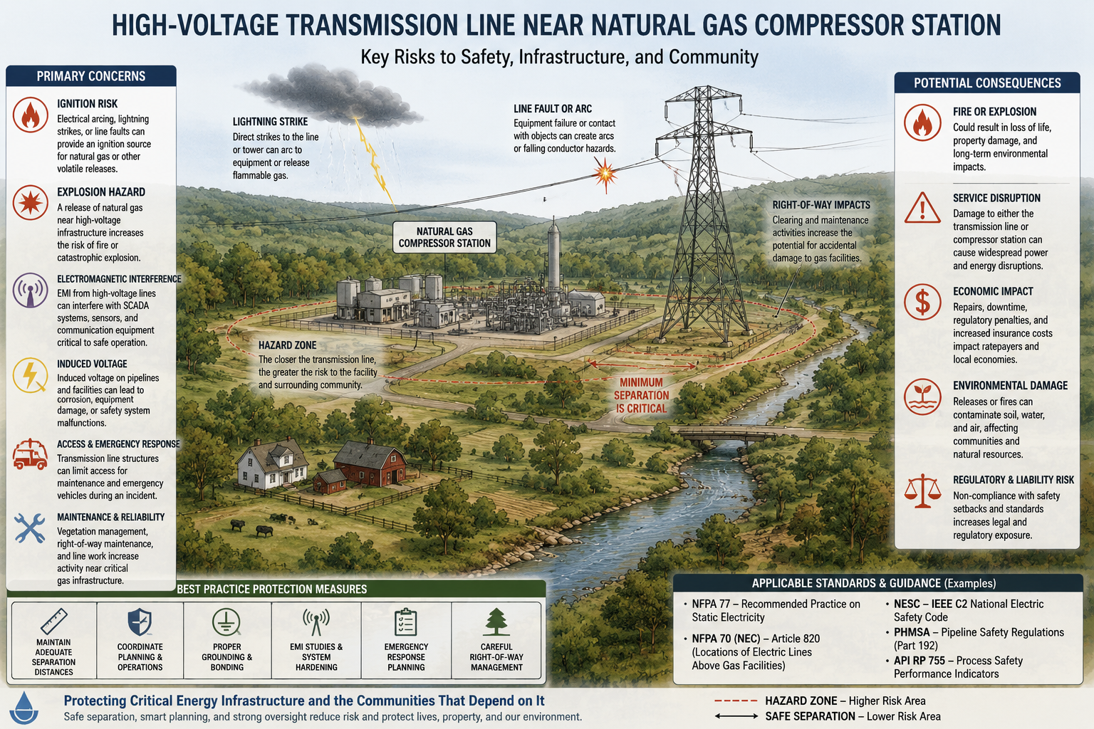
After entering Barbour County and initially crossing the Tygart Valley River near Belington, WV, the proposed Valley Link corridor passes within an estimated 329 feet of an active, recently expanded natural gas compressor station before continuing into one of the most environmentally connected portions of Koontz Hollow.
Material Omission of Critical Infrastructure
The public aerial display maps identify numerous individual natural gas wells along the corridor but do not identify the active natural gas compressor station located within an estimated 329 feet of the proposed 765-kV transmission line. Because compressor stations represent major energy infrastructure and operate under significantly different engineering and safety considerations than individual wells, this omission raises important questions regarding the completeness of the publicly presented siting information and the engineering analyses supporting the proposed corridor. This compressor station is fed by at least four nearby gas wells. There is also no mention of the angle of the gas lines in relation to the direction of the proposed transmission line.

Valley Link Provided Arial Map Section with Undisclosed Natural Gas Compressor Fed by at least Four Area Gas Wells. The gas wells are the blue dots. The compressor is left of the yellow line as it enters from the bottom part of the image.
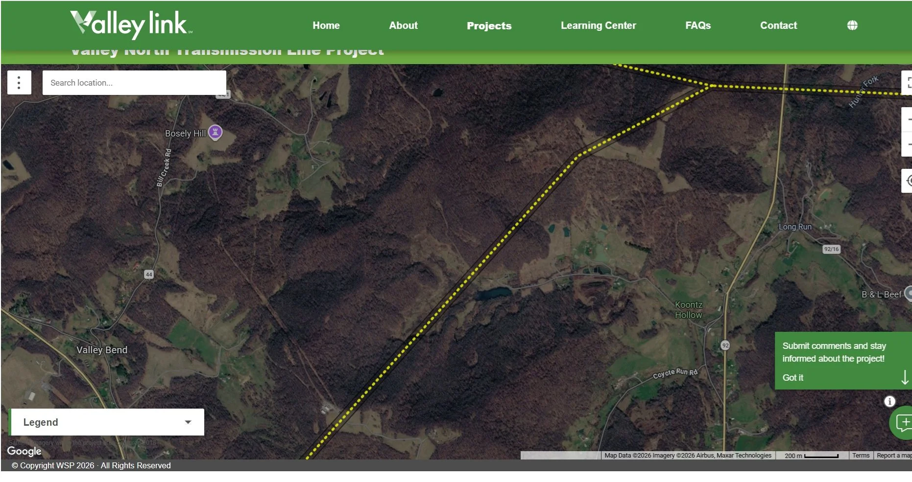
Caption: Valley Link Map Screenshot taken 06 27 26 with the unmarked gas compressor. The compressor is left of the yellow line as it enters from the lower left bottom of the image.
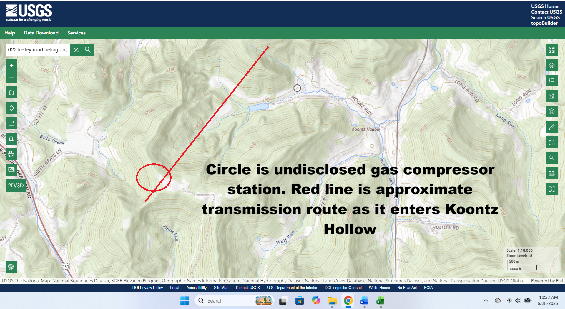
Topo map with area of undisclosed gas compressor circled. The red line is the approximate proposed transmission route by Valley North as it enters Koontz Hollow.
Engineering and Public Safety Considerations
High-voltage 765-kV alternating current (AC) transmission lines generate substantial electromagnetic fields. When located in close proximity to metallic natural gas infrastructure, these fields can induce voltage and current onto nearby pipelines, grounding systems, fencing, and compressor facilities. This phenomenon—commonly referred to as AC interference or induced voltage—is a recognized engineering issue that is routinely evaluated whenever high-voltage transmission facilities are proposed near pipeline infrastructure.
Potential engineering concerns include:
Induced AC voltage on nearby metallic infrastructure.
Interference with cathodic protection systems used to reduce pipeline corrosion.
Accelerated AC corrosion under certain operating conditions.
Touch-voltage and worker safety hazards requiring engineered mitigation.
Coordination between electric transmission owners and pipeline operators regarding grounding, maintenance, and long-term system reliability.
Because compressor stations contain high-pressure natural gas, electrical systems, automated controls, and critical safety equipment, their proximity to bulk electric transmission facilities typically requires detailed engineering review before construction.
Required Engineering Coordination
Construction of a 765-kV transmission line near an active compressor station is not simply a matter of obtaining property access. During final engineering and utility coordination, the proximity of the compressor station would require evaluation by both the electric utility and the natural gas operator to determine whether additional engineering measures are necessary to comply with applicable safety and pipeline protection standards.
Depending upon the final engineering analysis, mitigation measures may include:
Linear grounding conductors installed parallel to nearby pipelines to safely dissipate induced electrical current.
Decoupling devices designed to protect cathodic protection systems and sensitive electrical equipment from induced voltage.
Enhanced grounding systems surrounding compressor facilities to reduce touch-voltage and arc-flash hazards for maintenance personnel.
Additional engineering studies evaluating electromagnetic coupling, grounding performance, pipeline integrity, worker safety, and long-term maintenance coordination.
These mitigation measures can significantly increase project complexity, construction costs, permitting requirements, and coordination between utility owners.
Why This Matters
The issue is not simply the proximity of a transmission line to a compressor station. Rather, it is that the publicly available siting information appears to omit a major piece of critical infrastructure located within an estimated 329 feet of the proposed corridor.
When evaluating a 765-kV transmission project, the presence of nearby high-pressure natural gas infrastructure is an important engineering consideration because it may influence route selection, mitigation requirements, construction methods, long-term maintenance obligations, and public safety planning. If this infrastructure was not identified or evaluated in the publicly presented siting materials, it represents a significant issue that warrants careful review as part of the overall corridor evaluation.
Headwater Springs, Mountain Streams, and Watershed Connectivity
Beyond the natural gas compressor station, the proposed corridor enters one of the most environmentally connected portions of Koontz Hollow and leading into Hunter’s Fork. In Koontz Hollow, the corridor traverses three of the four mountain headwater streams that supply the hollow. These streams are sustained by underground springs that emerge along the ridge and provide the primary source of water for ponds, livestock, wildlife, and downstream aquatic ecosystems.
The headwater streams converge to form the primary hollow stream, which then flows into Sugar Creek. Sugar Creek is further sustained by tributaries originating in Hunter's Fork before continuing through Barbour County and ultimately returning its waters to the Tygart Valley River. As an additional blow to the watershed, on the ridge before crossing into Hunter’s Fork, the line crosses yet another headwater mountain spring that flows into sugar creek, for a total of four.
In other words, the Tygart Valley River watershed is encountered and negatively impacted three times.
The proposed corridor first crosses the Tygart Valley River itself, impacted by the initial clearcut. It then proceeds upstream into the very springs, headwaters, and tributaries that sustain that same river downstream, transporting with it, destroyed primary food chain nutrients that cannot be replaced at any point downstream, increased sediment, bank erosion, and increased water temperature, culminating in a dump back into the Tygart that then flows into Tygart Lake. Drilling at the top of these mountains where springs are located, in addition to running a line over them or drilling down where the spring is located cause many issues.
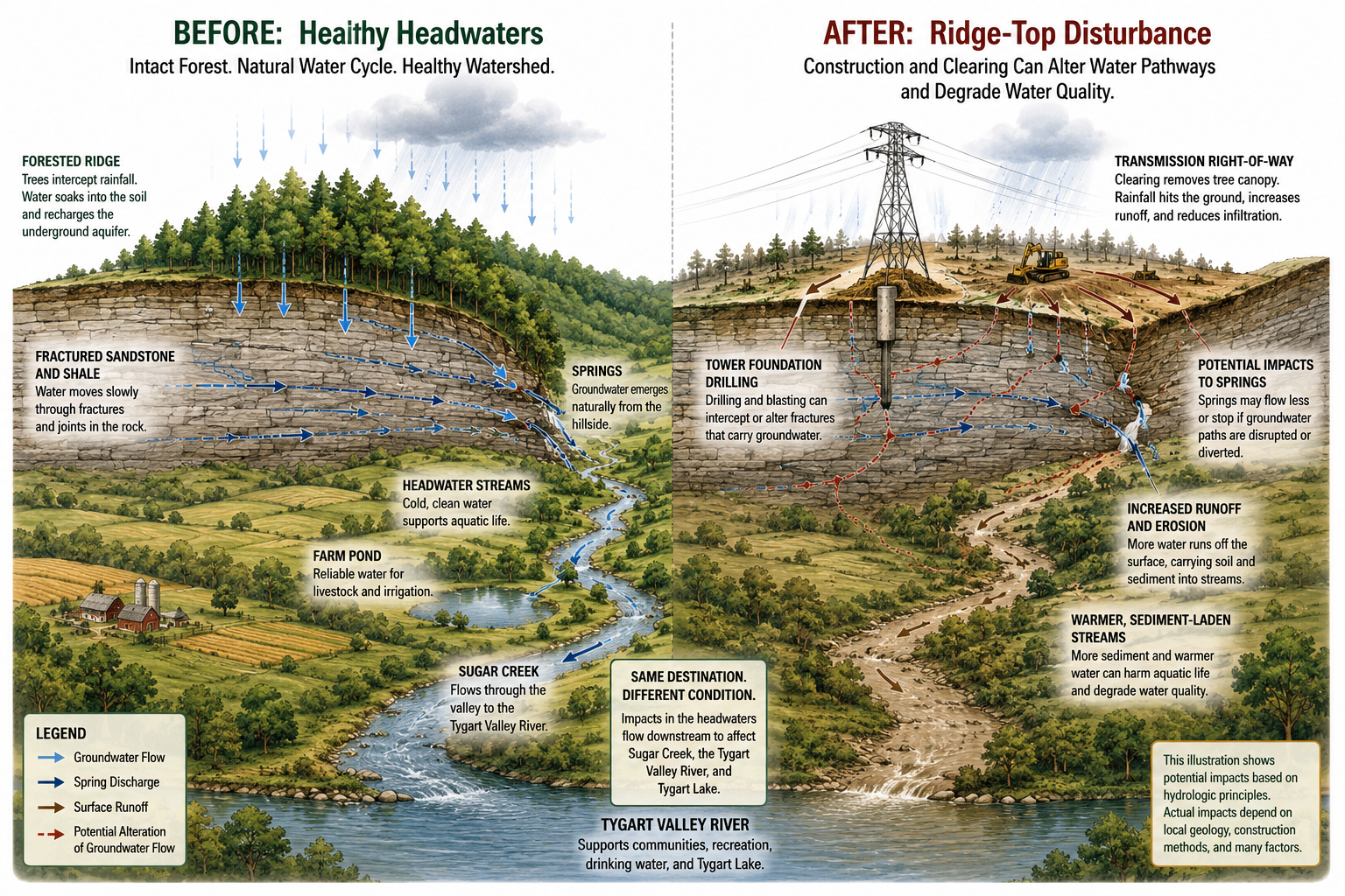
Recharge Area (Mountain Ridge): In the Appalachian Mountains, many springs are supplied by groundwater moving through fractures, joints, and, in some locations, limestone solution channels within the bedrock. Construction activities involving deep drilling, excavation, or blasting in these recharge areas have the potential to intercept or alter groundwater flow paths before water reaches the spring. Depending on the local geology, this may reduce spring discharge or redirect groundwater movement.
Discharge Area (Near the Spring): Drilling a well near a spring can intercept the same fracture network supplying the spring. When this occurs, groundwater may preferentially flow toward the well rather than emerging naturally at the spring, reducing spring flow or, in some cases, causing the spring to cease flowing. The extent of the effect depends on the local hydrogeology, the pumping rate, and the degree of hydraulic connection between the well and the spring.
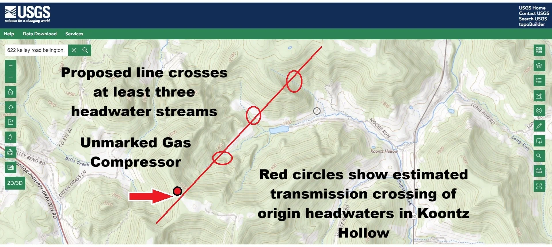
Topo map showing proposed transmission route by Valley Link, entering Koontz Hollow near an undisclosed gas compressor, fed by at least four area gas wells, proceeding northeast through three origin headwater mountain springs that feed Sugar Creek.
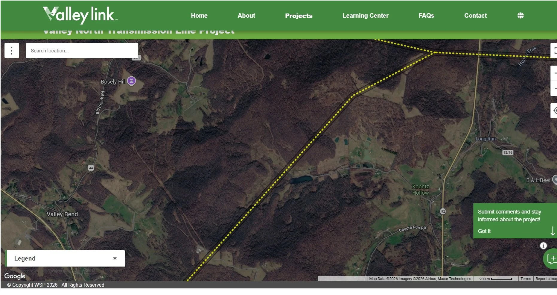
Valley Link Transmission proposed route passing near undisclosed gas compressor and proceeding to cross three origin headwater springs that feed Sugar Creek.
After crossing by the undisclosed gas compressor and potentially obliterating three ridge origin mountain springs that feed into Sugar Creek, the line then goes along the Koontz Hollow Ridge to cross yet a 4th origin ridge stream that also feeds Sugar Creek. A second proposed route comes in from the north and hits that same 4th spring before moving on into the headwaters of Hunter’s Fork that also feed Sugar Creek.
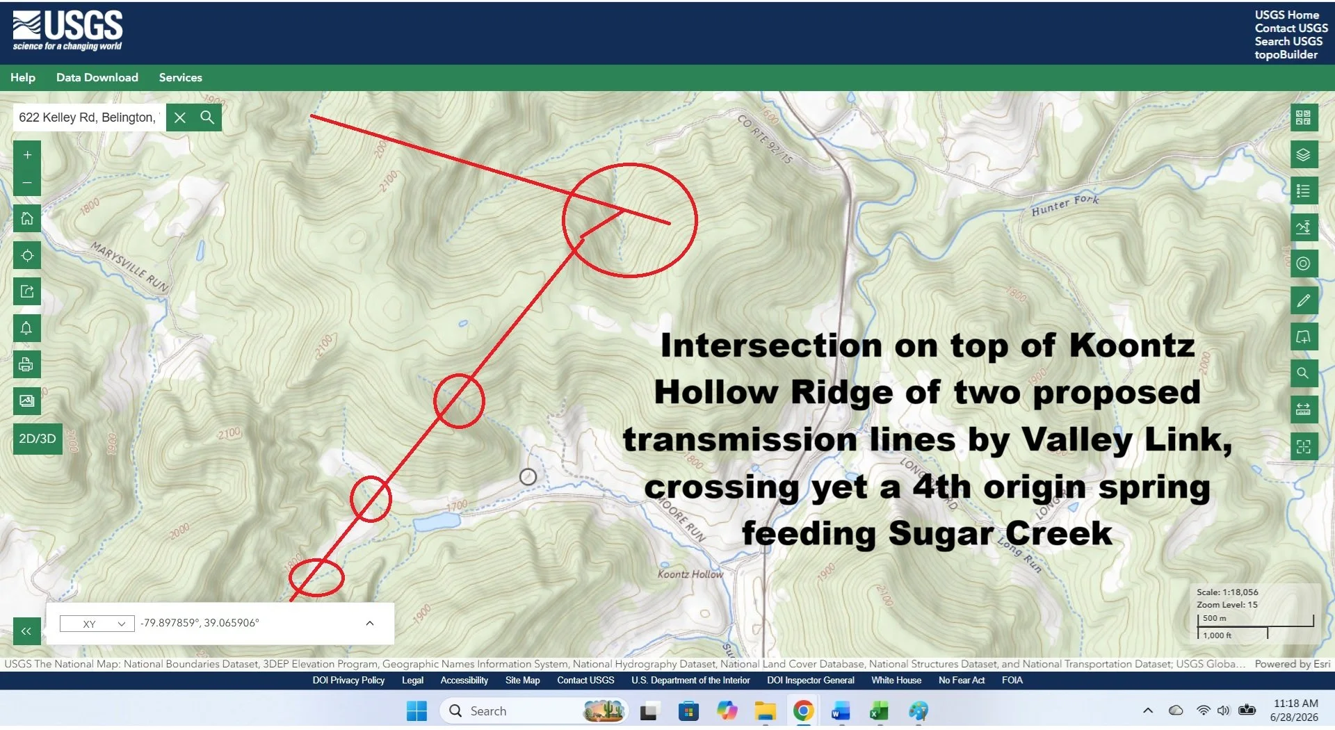
Topo map with transmission line routes showing four critical ridge origin streams feeding Sugar Creek.
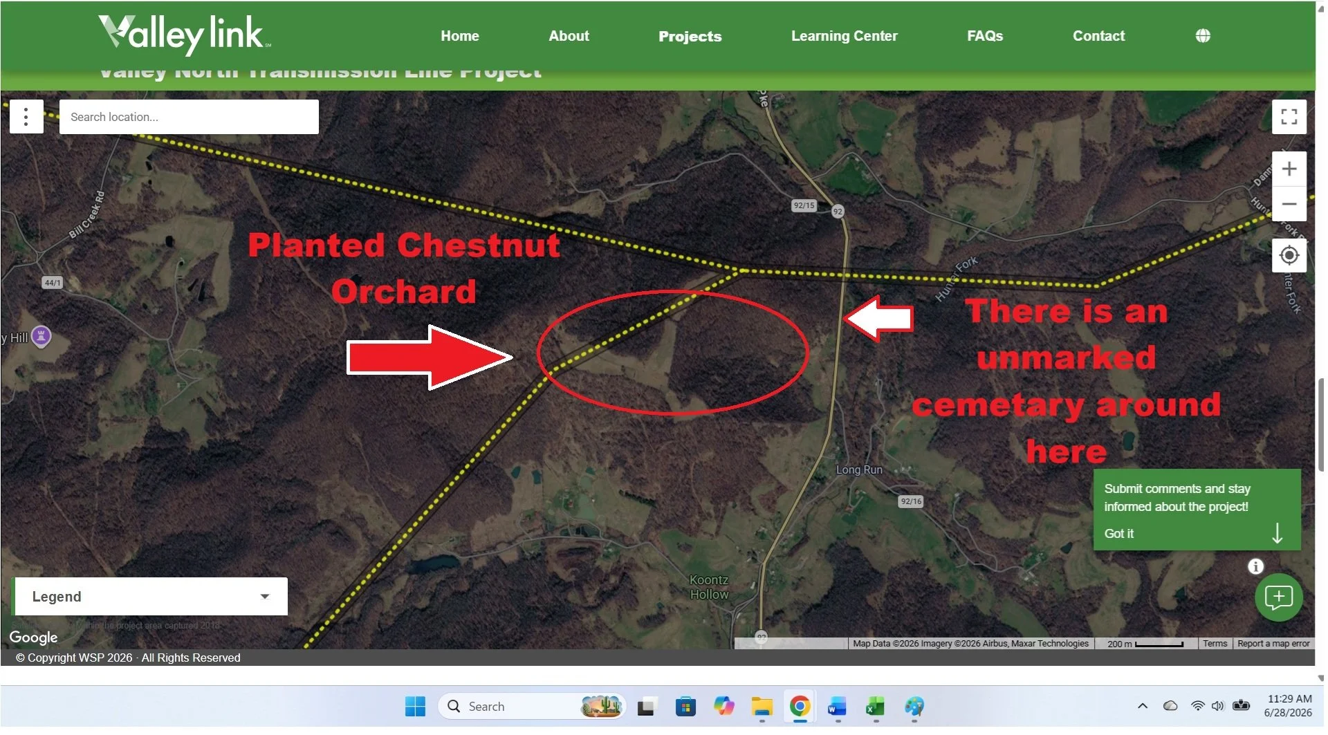
Valley Link map showing transmission lines crossing four critical origin ridge springs that feed Sugar Creek which flow through the rest of the county before merging with the Tygart River. After the 4th spring, on Koontz Hollow Ridge, the line runs over an already planted chestnut orchard and then goes down the ridge over an unmarked cemetery. And then….
The transmission line crosses over more origin headwaters flowing into Hunter’s Fork coming from the ridge between Barbour and Tucker County. These springs also mix with Sugar Creek. As you can see, as the route travels on through Hunter’s Fork, it has two route options, both of which cross two more origin waters that also flow into Sugar Creek.
This creates a decimation loop to the Barbour County watershed: 200 Foot across the Tygart from Belington, obliterating at least 6 headwater origin springs, from which the food chain nutrients cannot be replaced at an other point downstream, merging with Hunter’s Fork beginning waters, only to then dump into the Tygart again. Depletion of food chain ,higher temperatures and an even more impacted Tygart Valley River.
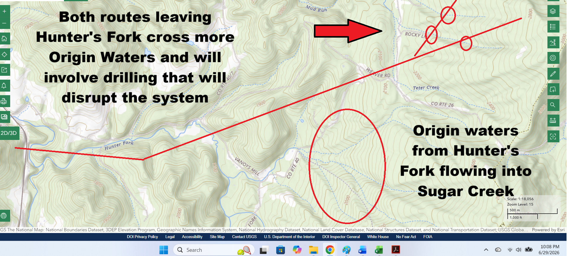
Topo map of Hunters Fork with the transmission line leading out of Koontz Hollow and running immediately over a stream coming directly from primary origin waters and feeding into Sugar Creek where it then mixes with the headwaters of Koontz Hollow before traversing through the county, carrying all negative transmission line contributions through the county and ending up once again in the Tygart Valley River before dumping into Tygart Lake.
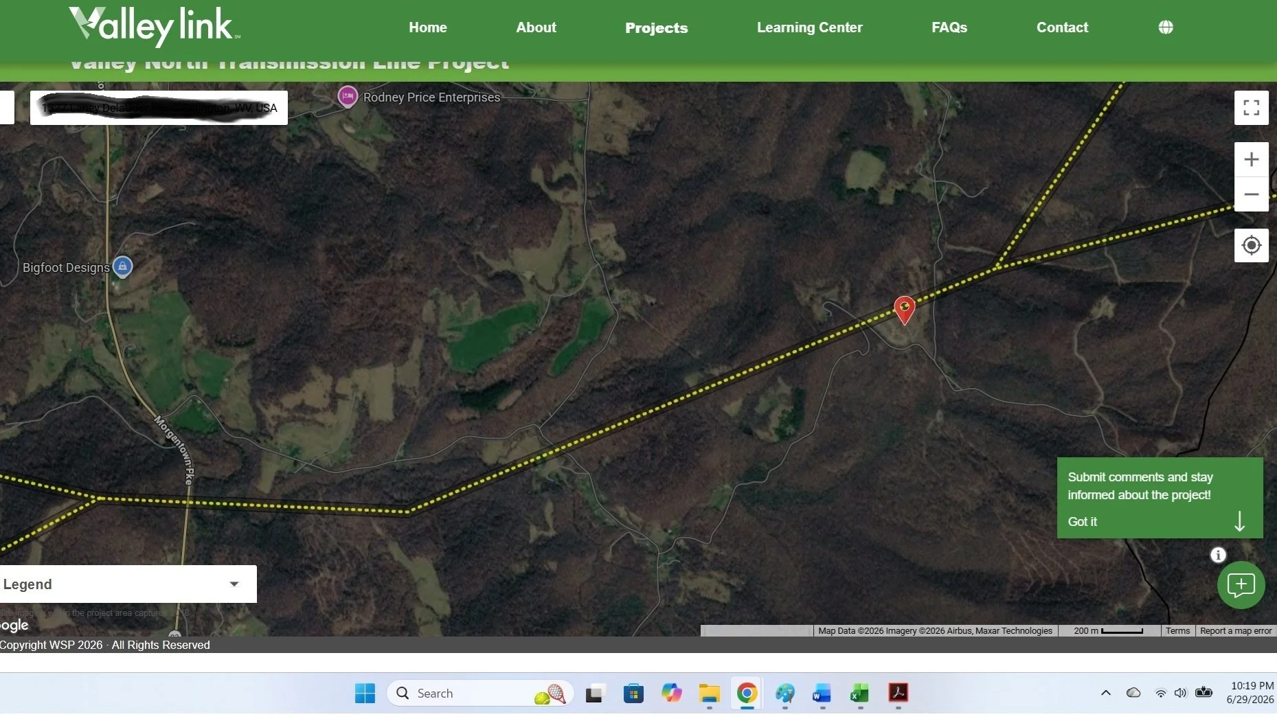
Valley Link map of transmission line leaving Koontz Hollow and into Hunter’s Fork
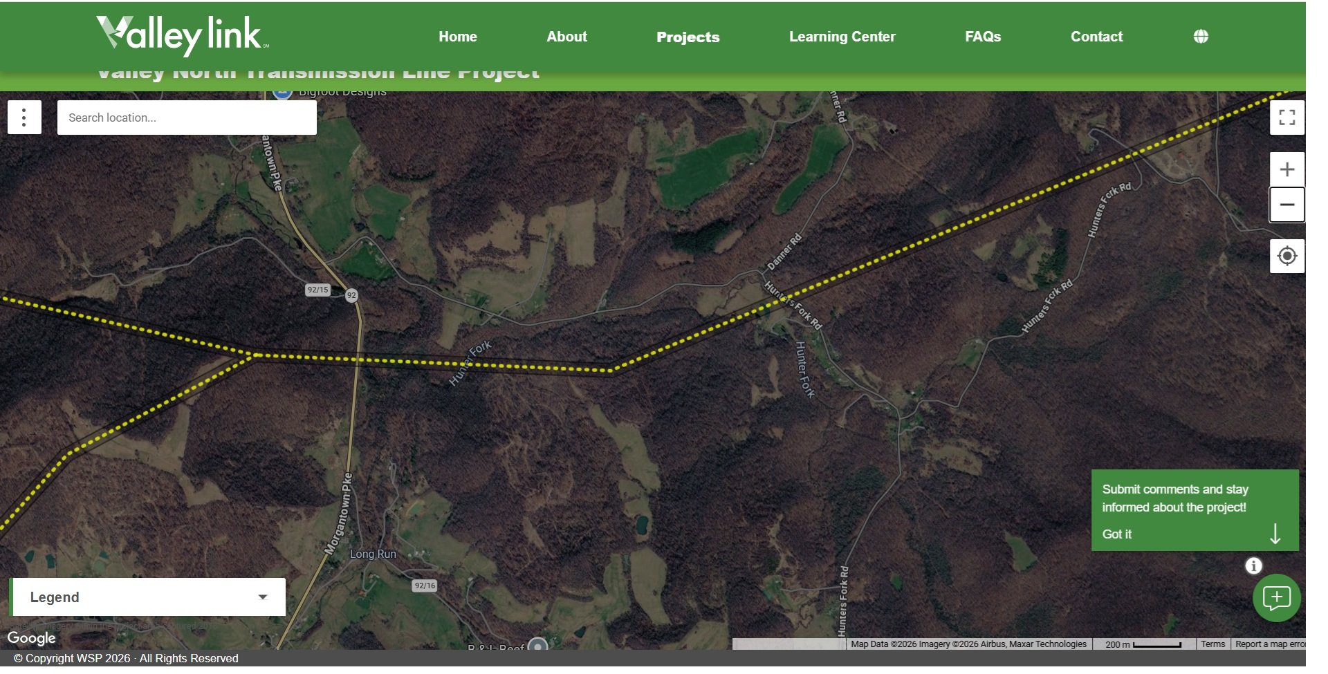
Valley Link map of southernmost proposed route of Valley Link Transmission - Valley North route through Koontz Hollow and Hunter’s Fork.
Why Headwaters Matter
The ecological health of the Tygart Valley River depends upon the condition of its tributaries and headwater streams. Although often small in size, these mountain streams perform some of the most important functions within the entire watershed.
Healthy headwaters:
Recharge underground groundwater systems and springs.
Maintain cool, temperature-stable water essential for aquatic plants, aquatic insects, amphibians, mussels, and fish.
Regulate downstream water temperatures and dissolved oxygen levels.
Stabilize streambanks and reduce erosion.
Reduce sediment transport into larger waterways.
Filter pollutants before they reach downstream rivers.
Sustain aquatic insects that form the foundation of the freshwater food chain.
Provide spawning, nursery, and refuge habitat for fish and other aquatic organisms.
Support birds, mammals, reptiles, pollinators, and countless other wildlife species that depend upon healthy riparian ecosystems.
Maintain water quality throughout the watershed while supporting agriculture and local communities.
Forested Ridges Are the Watershed's First Line of Defense
Forested Appalachian ridges are one of the watershed's greatest natural defenses against drought, flooding, erosion, and declining water quality.
The forest canopy intercepts rainfall before it reaches the ground, allowing water to slowly infiltrate the soil where it recharges underground aquifers and spring systems rather than immediately becoming surface runoff. This natural process performs two critical functions: it replenishes groundwater that feeds springs and streams throughout the year, and it slows the movement of stormwater across the landscape, reducing both the volume and velocity of runoff entering nearby waterways.
These mountain ridges receive some of the greatest amounts of precipitation in West Virginia because they form the watershed divides where the headwaters of streams and rivers originate. Healthy forests therefore act as enormous natural water storage systems, gradually releasing cool groundwater into streams long after rainfall has ended.
Conversely, when forested ridges are cleared for development or fragmented by roads and utility rights-of-way, the watershed begins to change.
The protective tree canopy is removed, rainfall reaches the ground with greater intensity, and stormwater moves more rapidly across exposed soils rather than slowly infiltrating into the ground. Road construction and grading can intercept shallow groundwater flow, reducing recharge to springs while increasing the amount of surface runoff entering streams.
The result is an interconnected chain of environmental impacts:
Increased stormwater discharge and flashier stream flows.
Greater flooding potential downstream.
Accelerated streambank erosion.
Increased sediment entering streams and rivers.
Loss of groundwater recharge that sustains springs during dry periods.
Warmer stream temperatures due to loss of riparian shade.
Degradation of aquatic habitat and water quality.
One of the most damaging consequences of excessive sedimentation is the burial of streambed habitat. Fine sediment covers the rocky substrate where aquatic insects live, feed, and reproduce. These insects are not simply another species within the ecosystem—they are the foundation of the freshwater food chain. When this habitat is buried beneath sediment, aquatic insect populations decline, affecting fish, amphibians, birds, bats, and countless other species that depend upon them for food. Unlike temporary disturbances, these ecological functions may require years or even decades to recover.
Streams and groundwater are not separate systems—they are inseparable components of the same watershed. Damage to one inevitably affects the other. Reduced groundwater recharge, increased stormwater runoff, streambank erosion, sedimentation, warmer water temperatures, and declining aquatic habitat all move downstream through the watershed before ultimately returning to the Tygart Valley River.
The concern is therefore not limited to a single crossing of the Tygart Valley River. The proposed corridor first intersects the river itself before continuing into the very springs, headwaters, and forested ridges that sustain it. Water originating from these underground springs and mountain streams eventually flows through Sugar Creek, joins the larger watershed, and returns once again to the Tygart Valley River.
The result is a corridor with the potential to affect the same watershed twice—first at the river crossing, and again within the interconnected network of spring-fed headwaters that ultimately replenish that river downstream. This transmission route negatively affects all of Barbour County and all of the transmission routes proposed by Valley Link Transmission negatively affect the entire county and state. We are bearing the brunt so that this line can feed data centers in the east.
The underground springs that sustain Koontz Hollow's headwater streams depend upon the natural movement of groundwater through fractured Appalachian bedrock. Construction of a 765-kV transmission corridor—including extensive tree clearing, access road construction, excavation, drilling, heavy equipment operation, and installation of massive concrete tower foundations—has the potential to alter these natural groundwater flow paths. Disturbance of the ridge-top soils and fractured rock can intercept or redirect groundwater before it reaches the springs, reducing groundwater recharge while increasing surface runoff, erosion, and sediment transport. Because these springs provide the primary source of cool, consistent water for the mountain streams below, changes to groundwater flow can affect stream temperature, water quality, aquatic habitat, and downstream watershed health. The concern extends beyond the individual spring itself: disruption of these interconnected groundwater systems can influence every stream, pond, tributary, and ultimately the Tygart Valley River that depends upon these headwaters.
This is why the location of the proposed corridor matters. It is not simply a transmission line crossing a river, nor is it only a corridor passing near critical infrastructure or traversing several mountain streams. It is a project that first intersects the Tygart Valley River, then continues into the spring-fed headwaters that replenish it. Those waters sustain farms, wildlife, and communities as they flow through Sugar Creek, continue through Barbour County, rejoin the Tygart Valley River, and ultimately feed into Tygart Lake. Along that journey, they support aquatic insects that form the foundation of the freshwater food web, maintain the cool, oxygen-rich habitat required by many native aquatic species, and contribute to the water quality and temperature conditions that support fish such as muskellunge (muskie) and numerous other temperature-sensitive species. Because watersheds function as interconnected systems, the cumulative effects of multiple disturbances to groundwater recharge, spring systems, headwater streams, erosion, sediment transport, and water temperature deserve careful consideration—not only for Koontz Hollow, but for the downstream resources, fisheries, recreation, agriculture, and communities that depend upon the Tygart Valley River and Tygart Lake.
When the Water is Gone
Aquifer and Spring System Disruption
The proposed 765-kV transmission corridor would require extensive ridge-top construction, including access roads, heavy construction equipment, excavation, and deep reinforced concrete tower foundations. In the Appalachian Mountains, natural springs are commonly sustained by groundwater moving through fractured sandstone, shale, and, in some locations, limestone formations. Disturbing these fragile subsurface flow paths has the potential to intercept, redirect, or reduce groundwater recharge before it reaches the springs. Any disruption to this interconnected groundwater system could diminish spring flow, affect the agricultural ponds they supply, and alter the headwater streams that originate on the property.
Headwater Stream Degradation
These spring-fed streams are not isolated waterways—they are the originating headwaters of a larger watershed. Headwaters perform critical ecological functions by supplying cool, clean water, regulating downstream temperatures, stabilizing streambanks, filtering sediment, and supporting aquatic insects that form the foundation of the freshwater food chain. Constructing and maintaining a wide transmission right-of-way through these headwaters would require removal of the protective forest canopy, increasing sunlight exposure, warming the water, accelerating erosion, and increasing sediment transport downstream. Because these impacts begin at the source of the watershed, their effects have the potential to extend far beyond the immediate construction area, influencing downstream water quality, aquatic habitat, and the ecological health of Sugar Creek, the Tygart Valley River, and ultimately Tygart Lake.