Risk to Artifacts, Culture and Preservation
Exploring the cultural heritage, historical landscapes, and archaeological significance of Koontz Hollow-Kelley Road and nearby Historic Hunter’s Fork.
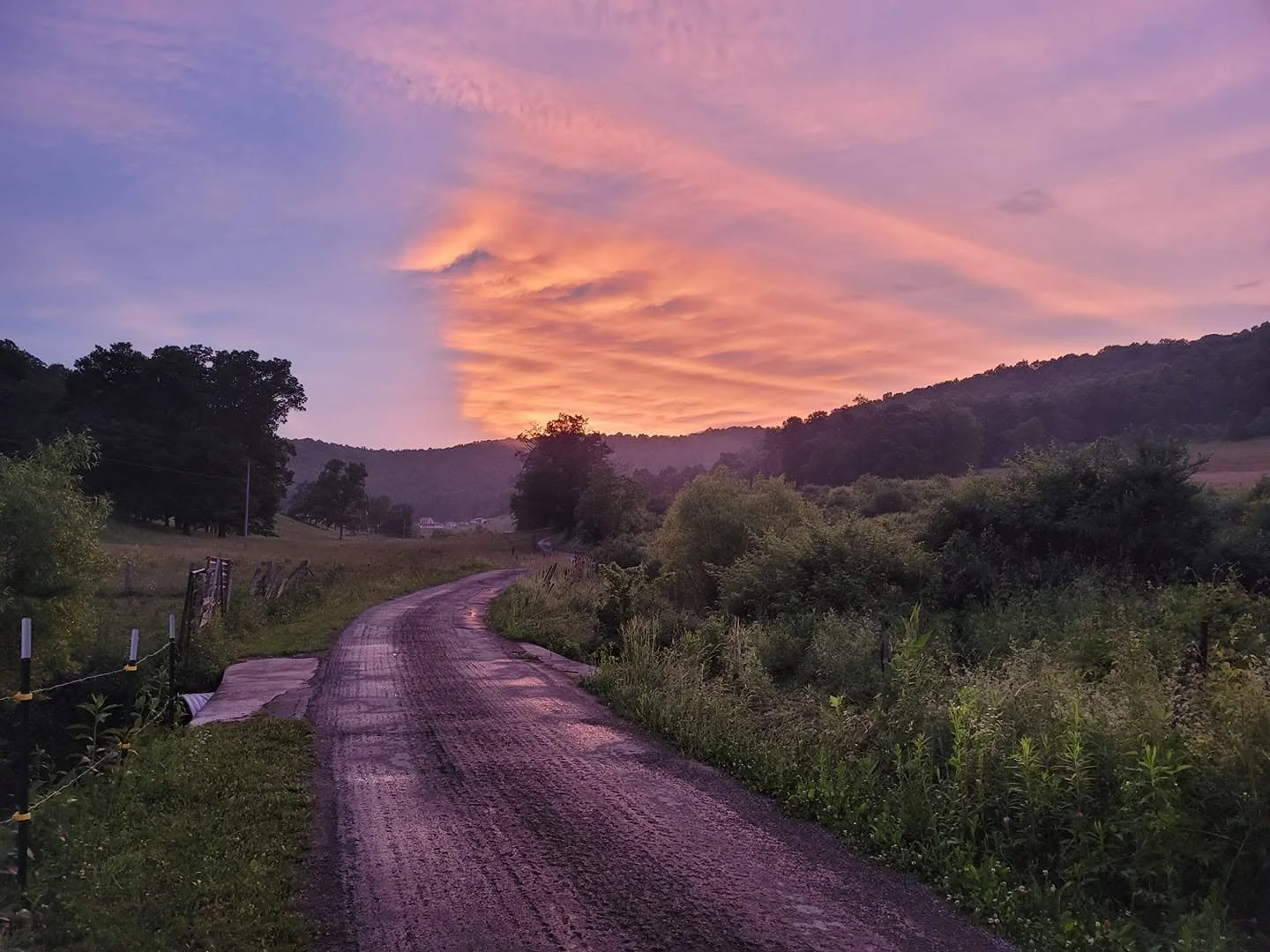
Koontz Hollow-Kelley Road at sunset. The ridge in the background holds traces of Eastern Woodland presence and is part of the landscape that people throughout time have called home. The ridge would potentially be scarred by the Valley Link-Valley North high voltage transmission line.
Cultural and Archaeological Significance
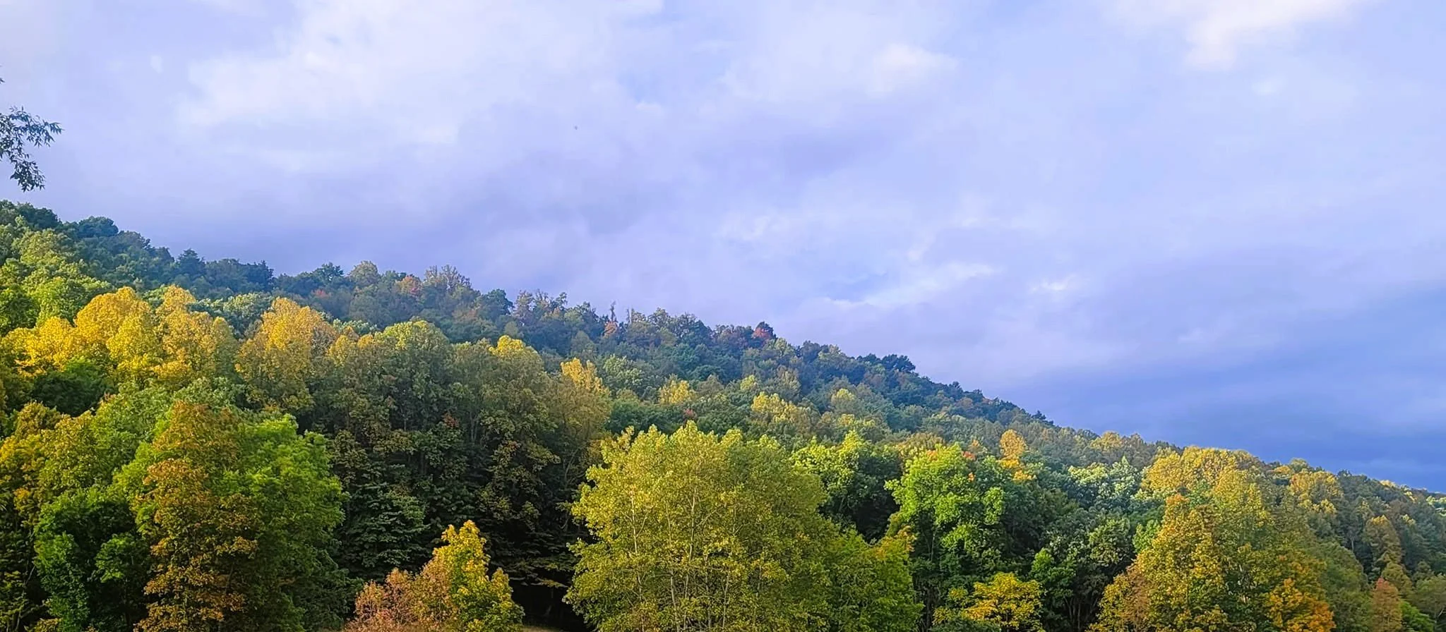
The region contains evidence of long-term human activity extending far beyond modern settlement. Eastern Woodland Native artifacts discovered within the area contribute to the understanding of the region's cultural history and underscore the importance of preserving historical and archaeological resources.
As additional research and documentation become available, this site will continue to provide information regarding the cultural significance of Koontz Hollow and surrounding areas.
Cultural Resources and Eastern Woodland Heritage
Koontz Hollow and the surrounding region are part of a landscape shaped not only by generations of family stewardship, but also by a much older human history. Artifacts discovered within the area, including prehistoric Eastern Woodland projectile points and a nutting stone, reflect the presence and activities of Indigenous peoples who lived, traveled, hunted, and gathered throughout these Appalachian hills long before European settlement.
The cultural story of the region is not confined to the past. Natural processes such as freeze-thaw cycles, erosion, and soil movement can periodically expose artifacts that have remained hidden for generations. As a result, the archaeological record continues to emerge over time, offering new opportunities to better understand the people who once occupied and utilized these landscapes.
Part of the conservation effort in Koontz Hollow involves not only the preservation and restoration of forests, wildlife habitat, and watersheds, but also the protection of cultural memory. Conserving the landscape helps preserve the historical context in which these artifacts are found and honors the legacy of the Eastern Woodland peoples whose connection to this region predates modern settlement by centuries.
The preservation of historic farms, forests, ridgelines, and archaeological resources contributes to a more complete understanding of the human history of Koontz Hollow and nearby Hunter's Fork.
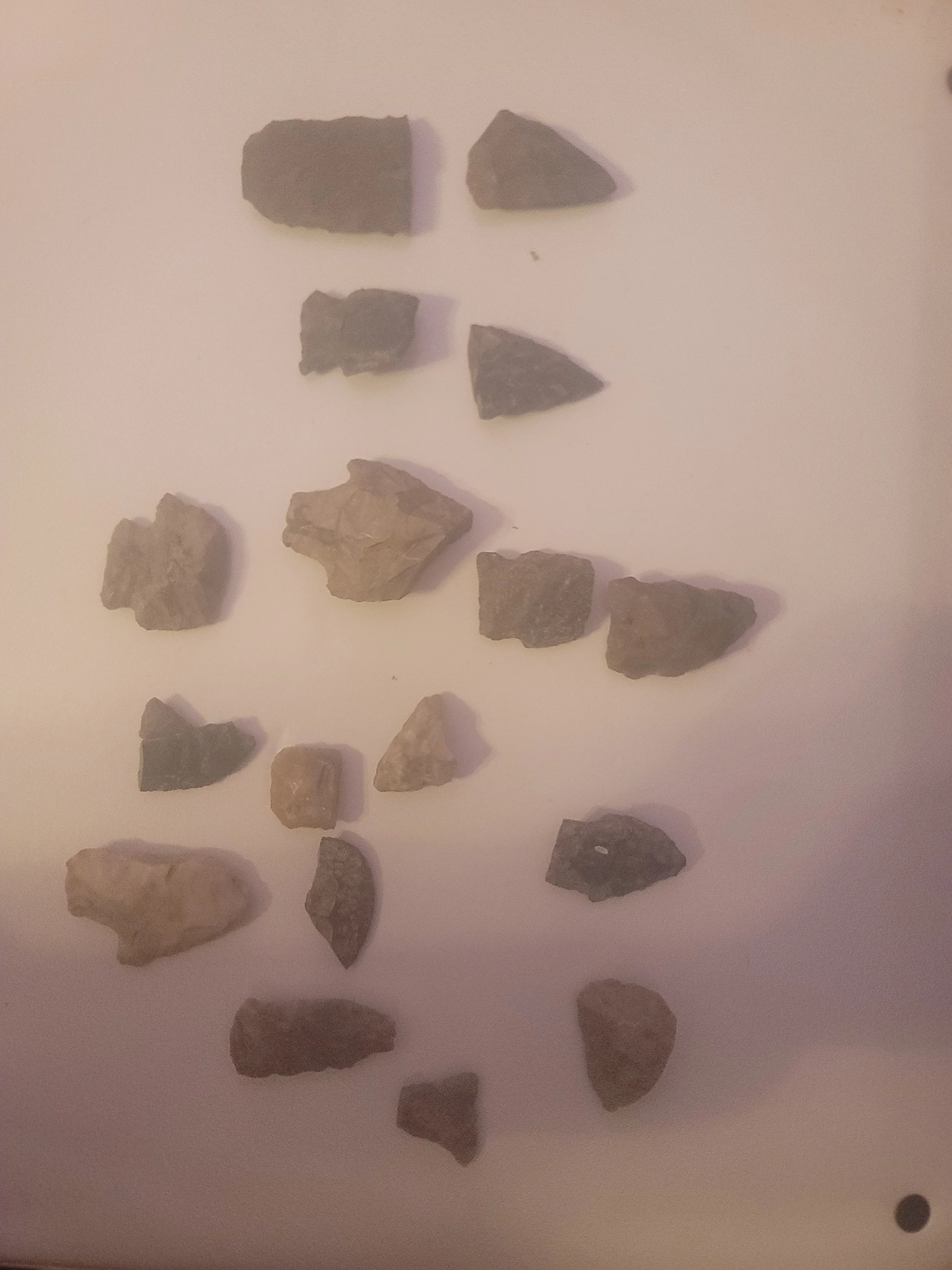
Prehistoric Eastern Woodland projectile points discovered in Koontz Hollow and reflecting centuries of Indigenous presence.
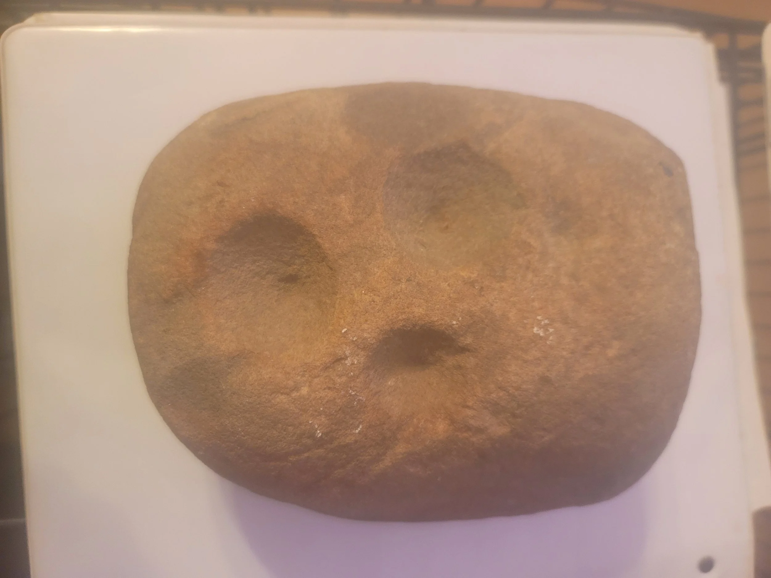
Prehistoric artifact: nutting stone used for food processing by Indigenous peoples of the Eastern Woodland tradition.
Wildcat Rock: Rock Shelter and Overlook - Along Koontz Hollow Ridge
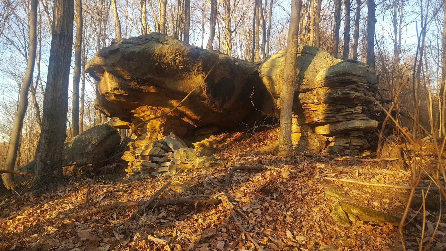
Wildcat Rock: Rock Shelter and Overlook - Along Koontz Hollow Ridge
The Legend of Wildcat Rock
The ridgelines and rock formations surrounding Koontz Hollow contain features that have attracted human use for generations. Wildcat Rock, a prominent natural rock shelter and overlook depicted on the below historic hand-drawn maps of the area, occupies a commanding position above the Koontz hollow and Kelley Road valley and provides both protection from the elements and expansive views of the surrounding landscape.
The elevated position of Wildcat Rock provides a clear view across portions of Koontz Hollow, Hunter's Fork, and the surrounding ridgelines. Such locations have historically offered advantages for observation, shelter, hunting, and travel throughout the Appalachian region. Evidence of past fire use was once visible beneath the overhang in the form of smoke-darkened rock surfaces, suggesting repeated human presence over time.
While additional archaeological study would be required to determine the full history of the site, its location illustrates how natural landforms can serve as places of shelter, observation, travel, and temporary occupation over long periods of time. The significance of the area is further reflected by Eastern Woodland Native artifacts discovered within the wooded portions of Koontz Hollow, including on the property associated with the historic Koontz Homestead and on the adjacent property, formerly part of the Koontz family holdings, where Wildcat Rock is located. Together, these discoveries contribute to the broader cultural landscape and historical record of Koontz Hollow and Hunter's Fork.
Wildcat Rock also occupies a place within local family history. According to documented family accounts, two young settler children once spent the night beneath the shelter after becoming stranded in the surrounding wilderness. The story reflects both the practical value of the rock overhang as a place of refuge and the realities of life in the early Appalachian frontier. Family records further note that the formation became known as "Wildcat Rock" during a period when wildcats still roamed the forests of the region, preserving a connection between the landscape and the natural history of Barbour County.
Family records indicate that even some of the earliest settlers regarded Wildcat Rock as a place that had been used before their arrival in the valley. The shelter's strategic location, natural protection, and commanding view of the surrounding landscape would have made it an attractive location for observation, temporary refuge, and travel throughout different periods of regional history. Together with Eastern Woodland Native artifacts discovered on nearby properties, these accounts contribute to the understanding of Wildcat Rock as part of a larger cultural landscape shaped by generations of human presence.
Wildcat Rock is situated along the ridgeline corridor currently proposed for the Valley Link transmission project. In addition to the area's cultural and historical significance, the ridge contains natural hydrological features that contribute to the surrounding landscape. Local springs originating within this area provide water to adjacent farms and contribute to headwater systems that ultimately feed into the greater Sugar Creek watershed, supporting agricultural land, pasture areas, wildlife habitat, and downstream water resources.
Preserving these locations helps maintain both archaeological context and the historical memory of human activity within the Appalachian region. As part of ongoing conservation and land stewardship efforts, documenting significant landscape features such as Wildcat Rock helps preserve cultural resources, historical landscapes, water resources, and the connection between the land and the people who have occupied, traveled through, and cared for it across generations.
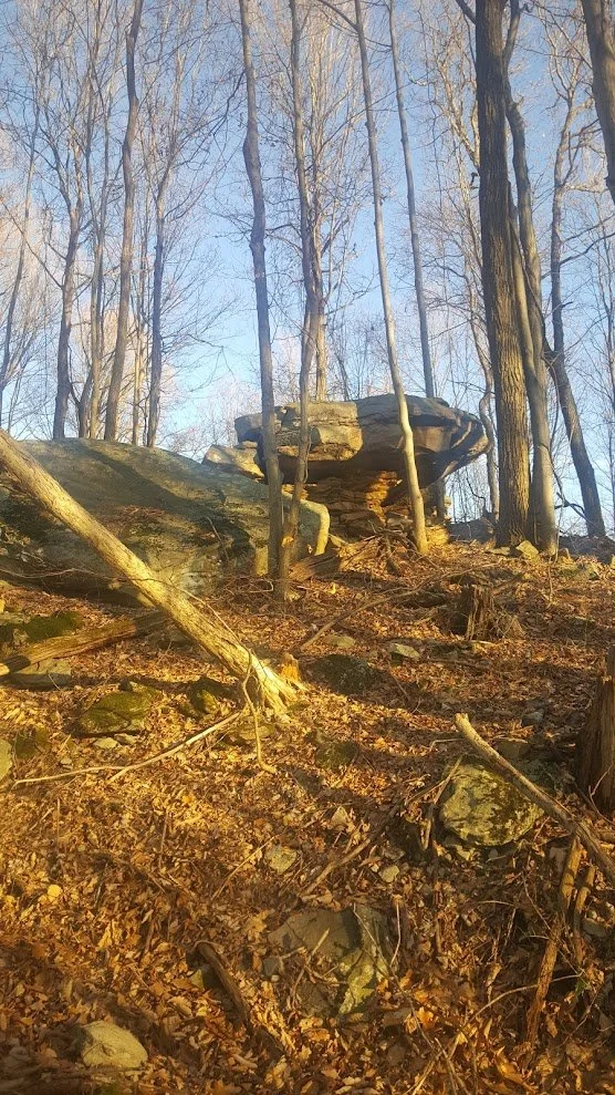
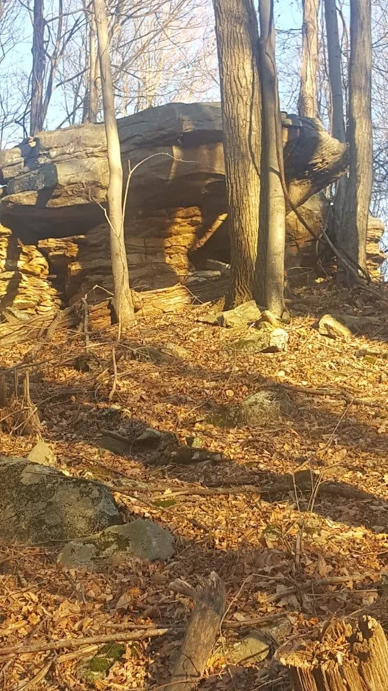
Wildcat Rock on top of Koontz Hollow Ridge
Closeup of Wildcat Rock on Koontz Hollow Ridge
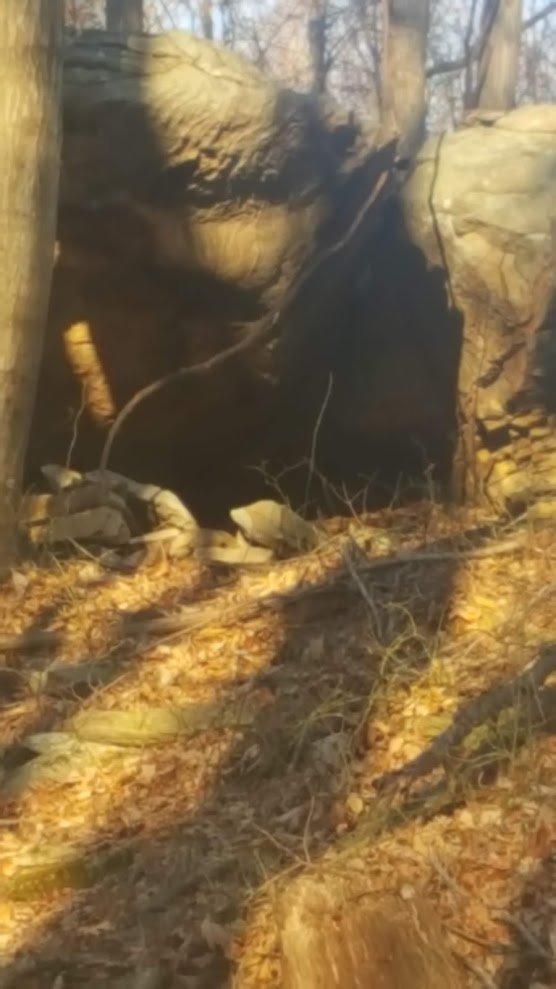
Closeup of Wildcat Rock shelter area along Koontz Hollow Ridge
A Landscape Recognized Through Time
Long before modern maps, aerial photography, and digital surveys, early residents, travelers, and historians documented the character of Barbour County through written descriptions and hand-drawn maps. These records provide a glimpse into how the region was understood by those who first settled and explored it.
Historic maps reveal a landscape defined by ridgelines, streams, hollows, farms, and small communities connected by winding roads and natural features. While methods of mapping have changed dramatically over time, many of the same landmarks remain recognizable today.
The historic descriptions and maps presented here help preserve the cultural memory of Koontz Hollow, Hunter's Fork, and the surrounding area. They offer valuable insight into the development of the region and serve as a reminder that these landscapes have long been regarded as places of both practical importance and enduring beauty.
Together with family histories, archaeological resources, historic photographs, and preserved landscapes, these records contribute to a richer understanding of the heritage of Barbour County and the communities that continue to call it home.
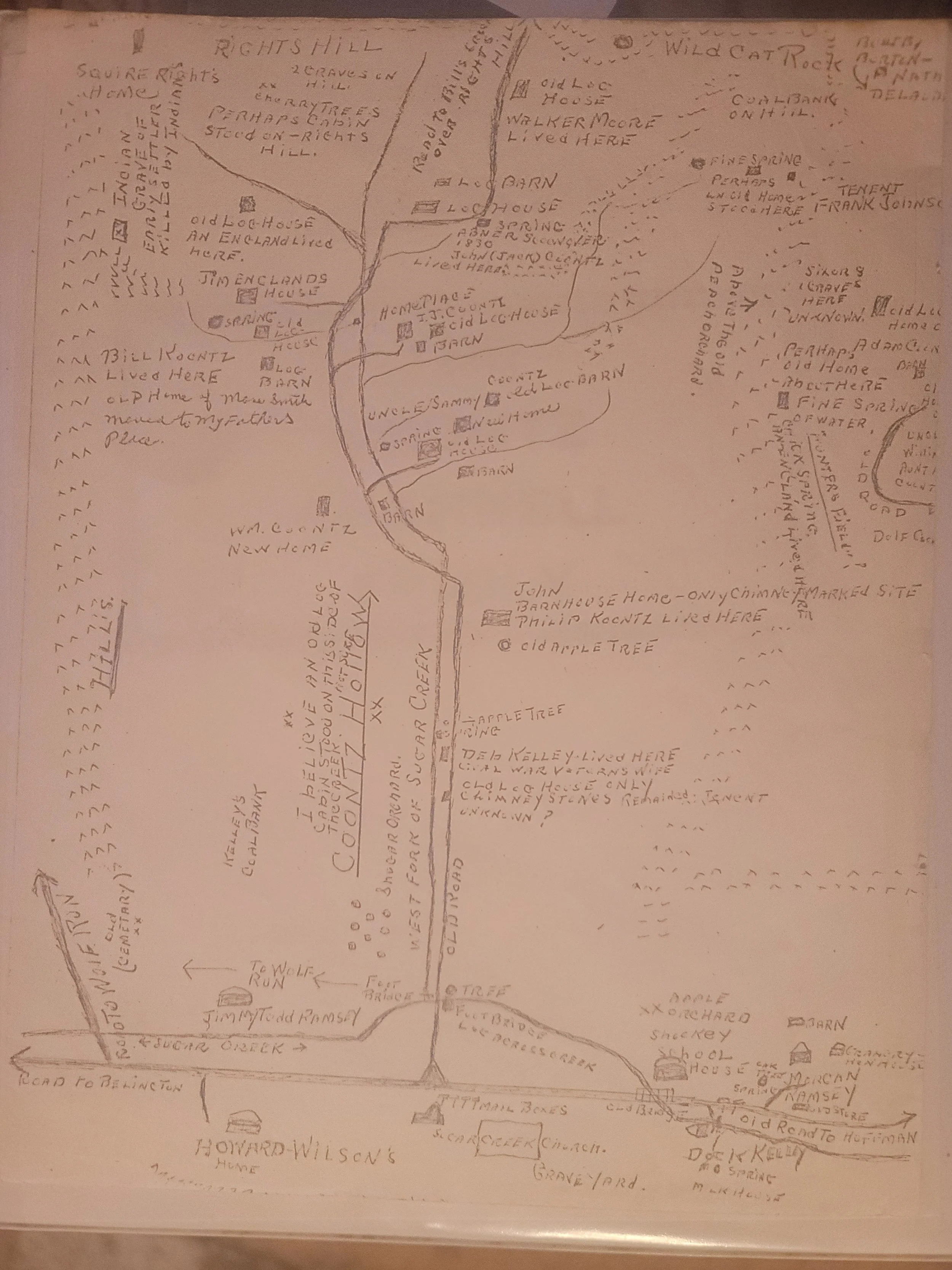
Hand-drawn map by ancestor recalling Koontz Hollow Settlements of the mid to late 1800s
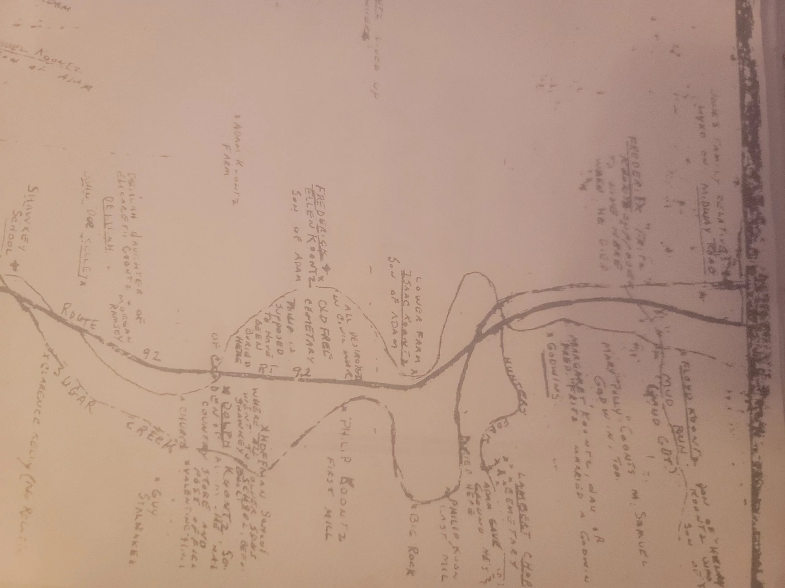
Hand-drawn map by ancestor recalling Koontz Hollow, Sugar Creek and Hunter’s Fork settlements of the early to late 1800s.
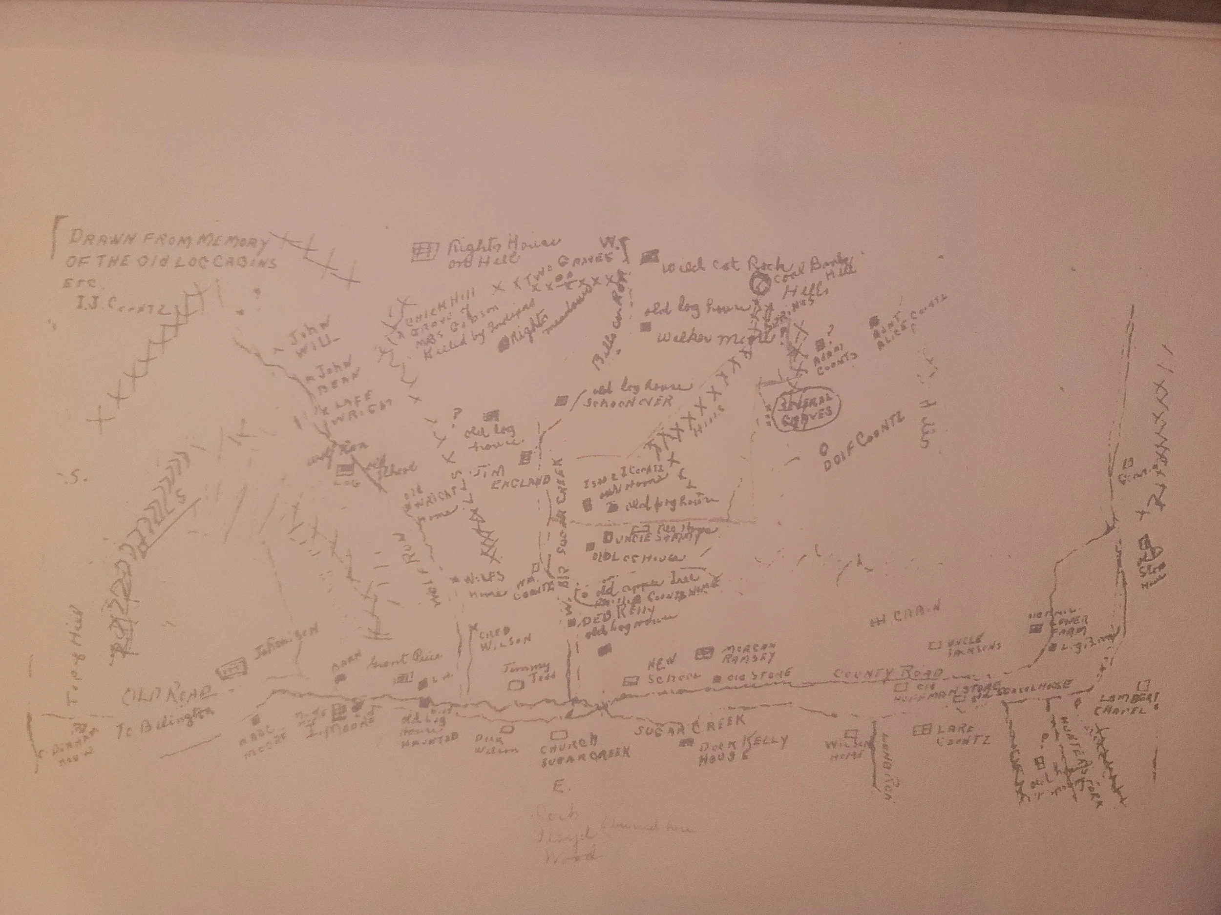
Hand-drawn map by ancestor recalling Koontz Hollow, Wolf Run, Shockey and Hunter’s Fork settlements of the early to late 1800s.
A Living Historic Landscape
The farms, forests, streams, and ridgelines of Koontz Hollow are part of an intentionally managed landscape shaped by generations of stewardship. While some portions of the area remain in active agricultural use, other wooded areas are being deliberately preserved in their natural condition.
These forests should not be viewed as vacant, unused, or lower-impact land. They provide wildlife habitat, watershed protection, soil stability, privacy, natural regeneration, and long-term restoration of family property. In many cases, allowing land to return to forest is itself a conscious land-management decision that reflects conservation and stewardship goals developed over generations.
As discussions regarding the proposed Valley North and Valley Link transmission projects continue, it is important to recognize that wooded portions of affected properties represent an intentional and valuable land use—not simply open space available for development or routing and are at risk by transmission line impacts.
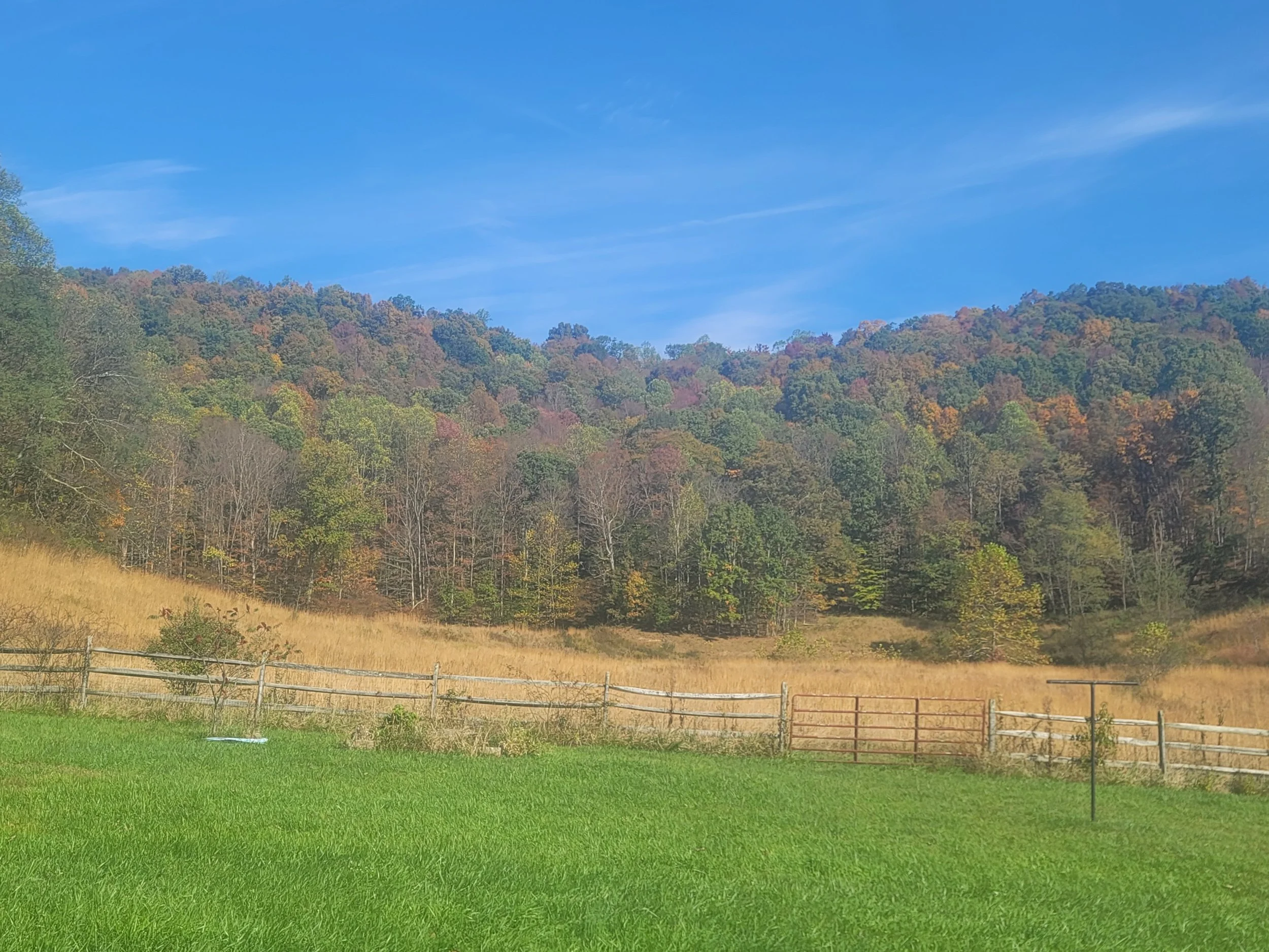
Ridge behind Koontz Homestead that has intentionally not been timbered for carbon offset forestry and that holds the last remaining viable source of water. This same ridge would have been destroyed by the Potomac Appalachian Transmission Highline (PATH) and now Valley North. The wooded area also holds graves, foundations from older settlements and Eastern Woodland artifacts.
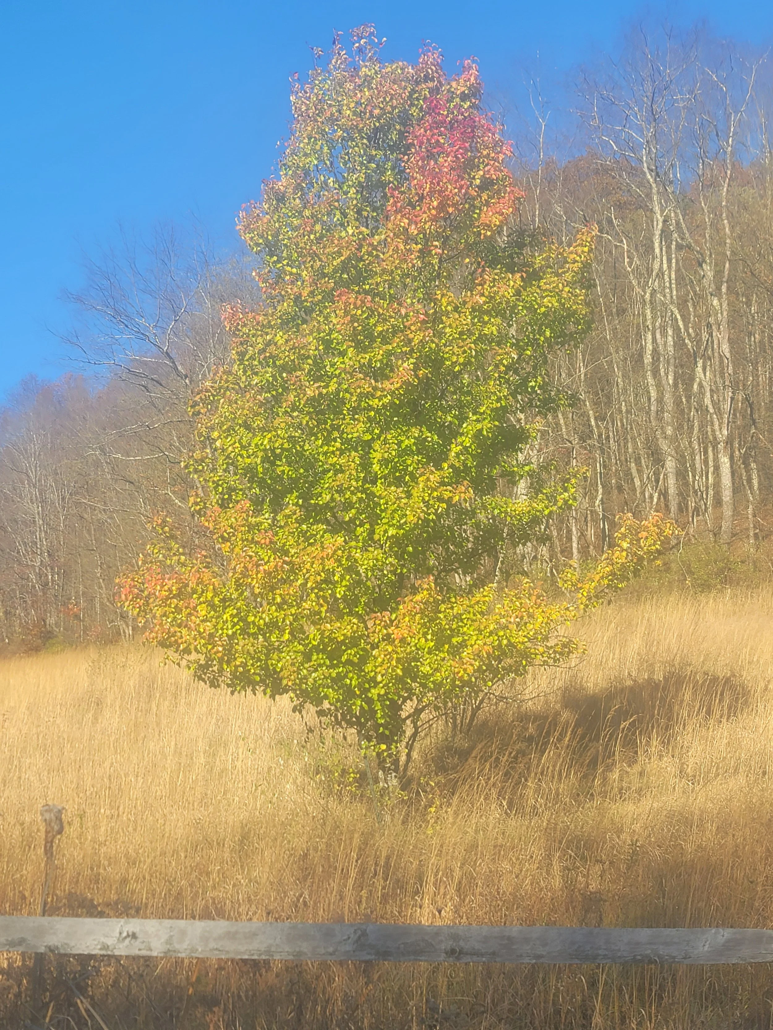
Trees planted to stabilize the slopes and to increase wooded area
Protected Wildlife Habitat
The historic meadow immediately behind the Koontz Homestead, identified within the State Historic Preservation Office (SHPO) documentation, also serves as important wildlife habitat. Photographs and video documented from the property show regular use of this area by a bald eagle (Haliaeetus leucocephalus) and a great blue heron (Ardea herodias), two species protected under federal wildlife laws. Their continued presence reflects the ecological value of the surrounding forests, spring-fed streams, wetlands, and open agricultural landscape that have remained largely intact for generations.
This habitat exists within a much larger interconnected ecosystem. Koontz Hollow and Hunter's Fork lie entirely within the U.S. Fish and Wildlife Service Rusty Patched Bumble Bee Low Potential Zone, an area identified to facilitate the expansion and connectivity of habitat for one of North America's most imperiled native pollinators. The intact forests, meadows, streams, and native vegetation throughout the hollow support pollinators while also providing habitat for birds, mammals, amphibians, and other wildlife that depend upon healthy headwater ecosystems.
The mountain spring that originates immediately upslope of this meadow is a critical part of that ecosystem. Clear-cutting the forest above the spring, together with the excavation, drilling, and construction required for 765-kV transmission tower foundations, would directly disturb the recharge area and groundwater flow paths that sustain it. Any reduction or alteration of the spring's natural flow would affect far more than a single water source—it would diminish the spring-fed habitat that supports the surrounding ecosystem, reduce the water supplying the pond where the great blue heron regularly feeds, and degrade the mature woodland habitat used by the resident bald eagle family for nesting, hunting, and raising their young. The loss or degradation of this spring would ripple throughout the living landscape, affecting wildlife, pollinators, agricultural resources, and the interconnected headwater system that ultimately feeds Sugar Creek and the Tygart Valley River.
The continued presence of protected wildlife alongside historic farmsteads, productive agricultural land, spring-fed headwaters, and federally recognized pollinator habitat demonstrates that Koontz Hollow is more than a collection of individual resources. It is a living cultural landscape where history, agriculture, wildlife, and ecological function remain interconnected. The SHPO mapping reflects the historic significance of this landscape, while the continued use of the area by protected species illustrates that it also retains exceptional environmental value today.
"The photographs and videos below were documented on the property and illustrate the continued use of this intentionally managed historic landscape by federally protected wildlife."
Video of Bald Eagle at the Old Koontz Homestead in Koontz Hollow/Kelley Road.

Bald Eagle circling in the sky before coming in for a landing at the Old Koontz Homestead

Bald Eagle in the sky over Koontz Hollow
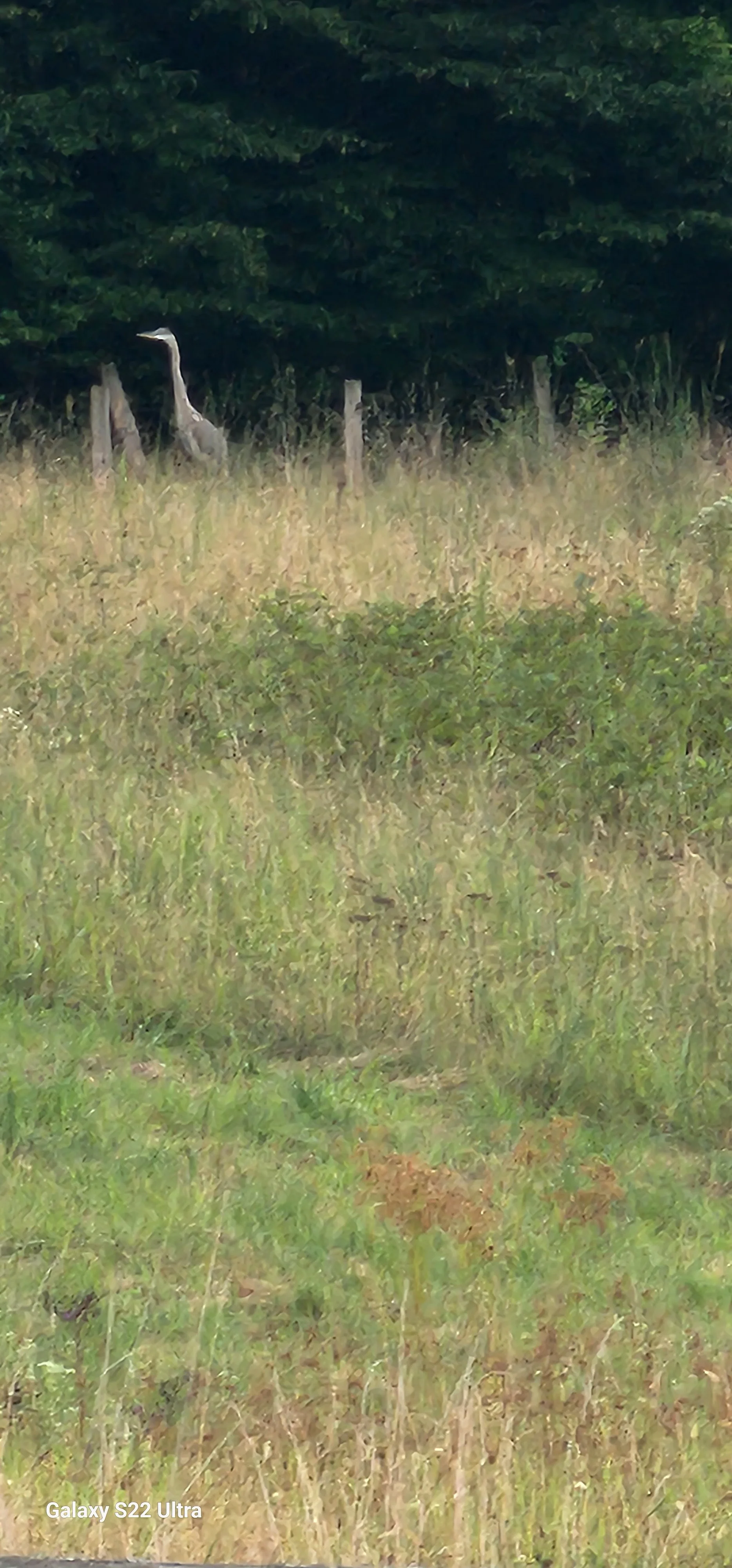
Blue Herron near pond which is fed solely by last remaining mountain spring behind the Old Koontz Homestead
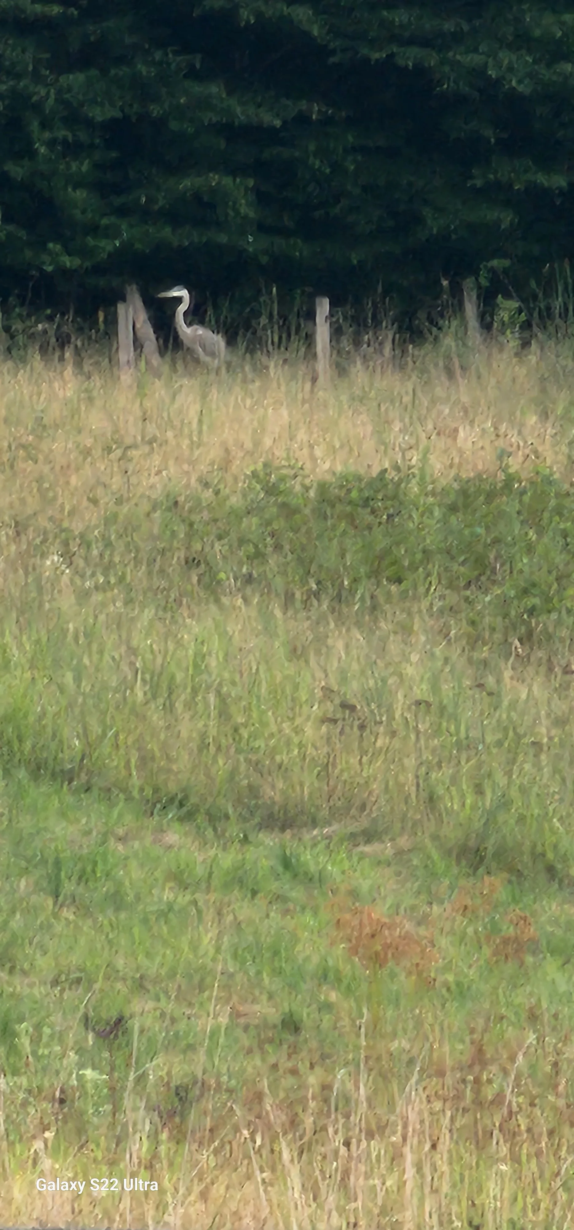
Blue Herron near pond which is fed solely by last remaining mountain spring behind the Old Koontz Homestead
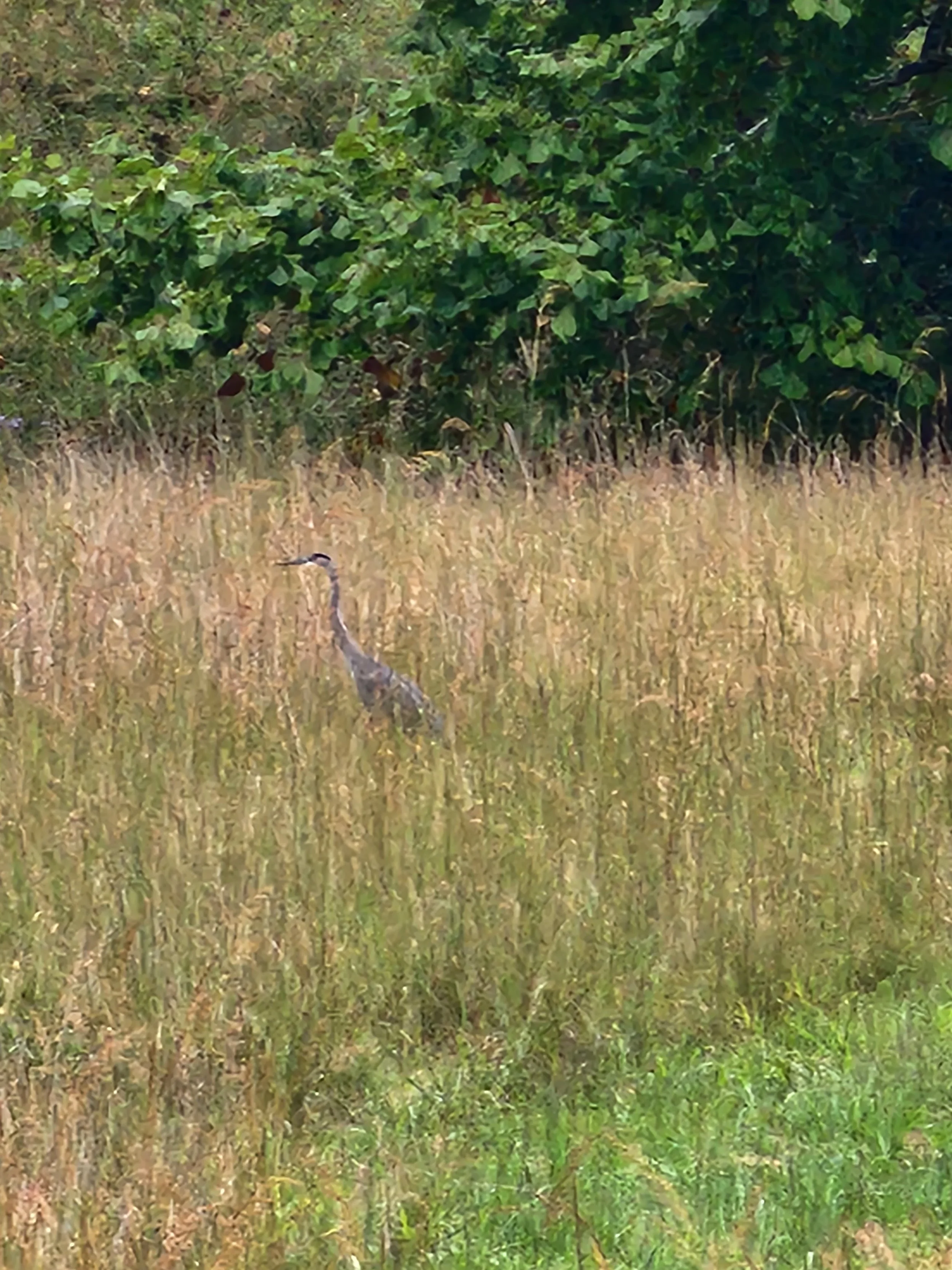
Blue Herron near pond which is fed solely by last remaining mountain spring behind the Old Koontz Homestead
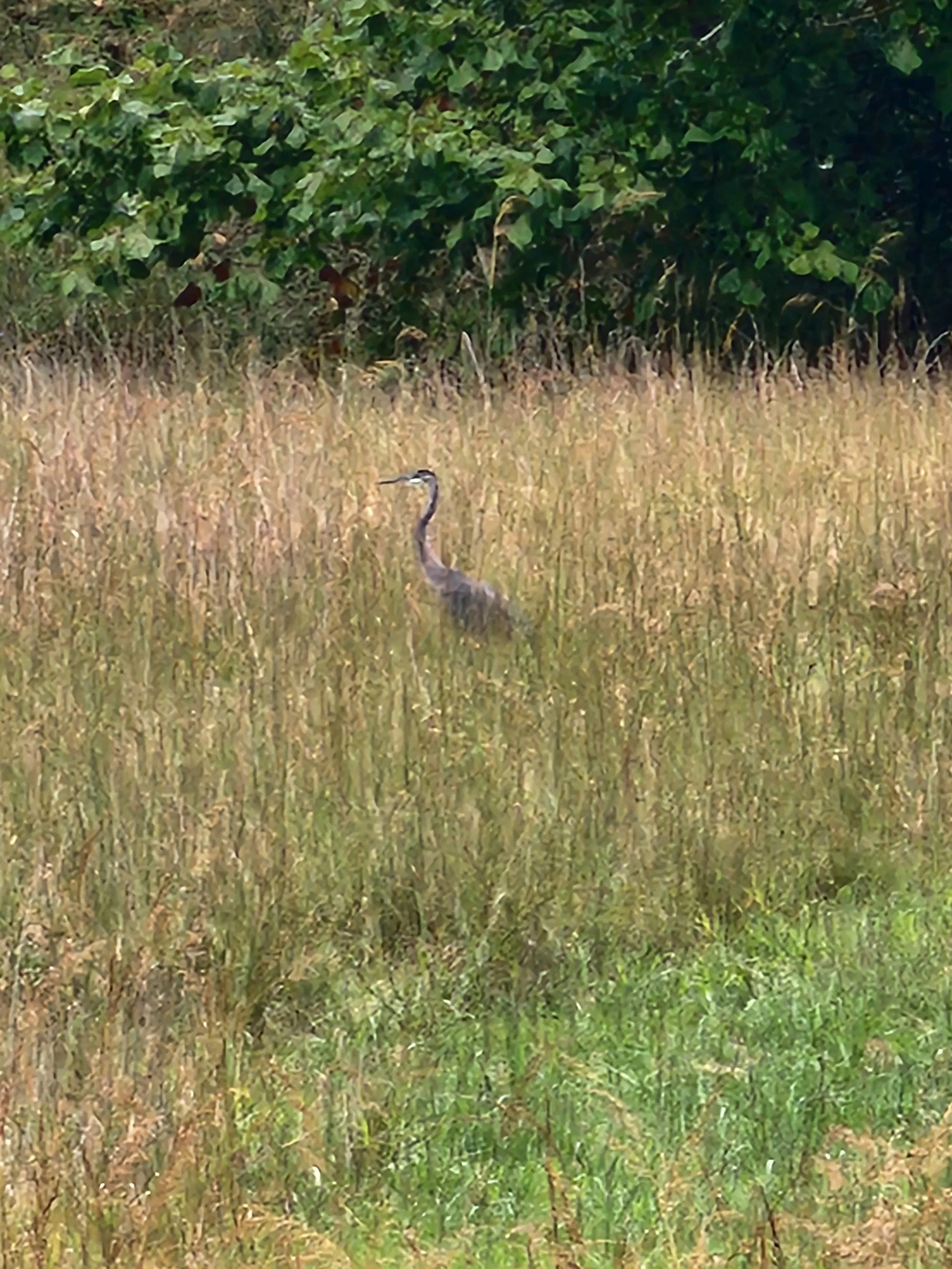
Blue Herron near pond which is fed solely by last remaining mountain spring behind the Old Koontz Homestead
West Virginia State Historic Preservation Office - SHPO Concerns
Following Hurricane Sandy, Tetra Tech, Inc. conducted cultural resource surveys for the State Historic Preservation Office (SHPO), documenting historic properties throughout the region. Several resources within Koontz Hollow were identified and placed on the SHPO inventory because of their historical significance and integrity. Today, that work continues, as one of the historic farmsteads is being prepared for nomination to the National Register of Historic Places—a testament to the enduring cultural, agricultural, and architectural heritage preserved within the hollow.
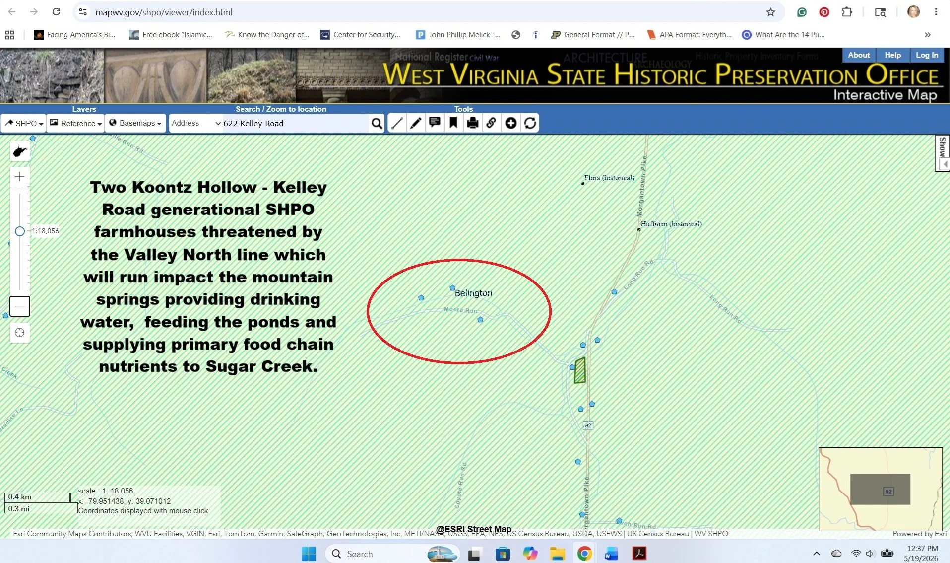
West Virginia State Historic Preservation Office Map depicting the the two generational farmhouses shown on this website in Koontz Hollow - Kelley Road. A proposed Valley North line runs through these properties and impact the water, habitat and history.
Rusty Patched Bumble Bee - Recovery of the First Federally Listed Pollinator
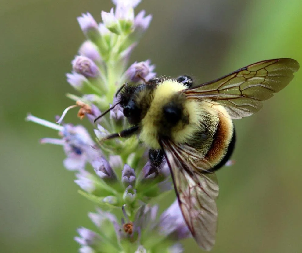
Rusty Patched Bumble Bee (Bombus affinis), a federally endangered pollinator species identified by the U.S. Fish and Wildlife Service as a conservation priority. The entirety of Koontz Hollow and Hunter's Fork area fall within a designated Low Potential Zone established for scientific recovery surveys and additional conservation efforts intended to support long-term species recovery.
Photo credit: Dawn Marsh, U.S. Fish and Wildlife Service (courtesy photo).
In case you missed it on the Historical and Environmental Impacts Page, According to U.S. Fish and Wildlife Service mapping resources, the two southern proposed routes going through Barbour County that include portions of the Koontz Hollow and Hunter's Fork area, fall within a Rusty Patched Bumble Bee Low Potential Zone identified for scientific recovery surveys and additional conservation efforts. While Low Potential Zones do not indicate confirmed occupancy, they form part of a broader recovery strategy intended to support habitat expansion, population monitoring, and long-term conservation of the species.
The Rusty Patched Bumble Bee (Bombus affinis) was listed as endangered under the Endangered Species Act in 2017, becoming the first bumble bee species in the United States to receive federal protection. Historically widespread throughout much of its range, the species experienced a rapid and substantial decline prior to listing. Scientists have identified habitat loss, introduced pathogens, pesticide exposure, climate-related stressors, and population fragmentation as contributing factors.
In 2024, the U.S. Fish and Wildlife Service designated approximately 1.5 million acres of critical habitat for the species across portions of Illinois, Iowa, Minnesota, Virginia, West Virginia, and Wisconsin. Conservation of native bumble bees has been recognized as both an ecological and economic priority because of their role in pollinating native plants, supporting biodiversity, and contributing to agricultural productivity and food security.
The forests, meadows, agricultural lands, flowering resources, and undeveloped habitats associated with Historic Koontz Hollow and Hunter's Fork reflect many of the landscape characteristics that conservation programs seek to maintain and enhance throughout the species' remaining range. As a designated Low Potential Zone identified for additional conservation efforts, the area may contribute to future habitat connectivity and species recovery objectives.
Although critical habitat designations do not create public access rights or convert private property into protected reserves, federal endangered species considerations may become relevant when projects involve federal permitting, federal approvals, federal funding, or other federal agency actions. Because the proposed Valley Link transmission project is an interstate infrastructure project requiring extensive regulatory review, additional evaluation of pollinator resources and habitat conditions may warrant consideration as part of any future environmental review process.
The purpose of documenting these resources is not to establish the confirmed presence of the Rusty Patched Bumble Bee within Koontz Hollow or Hunter's Fork, but rather to recognize the area's location within a federally identified recovery landscape and to encourage further study before irreversible changes are made to the surrounding environment.
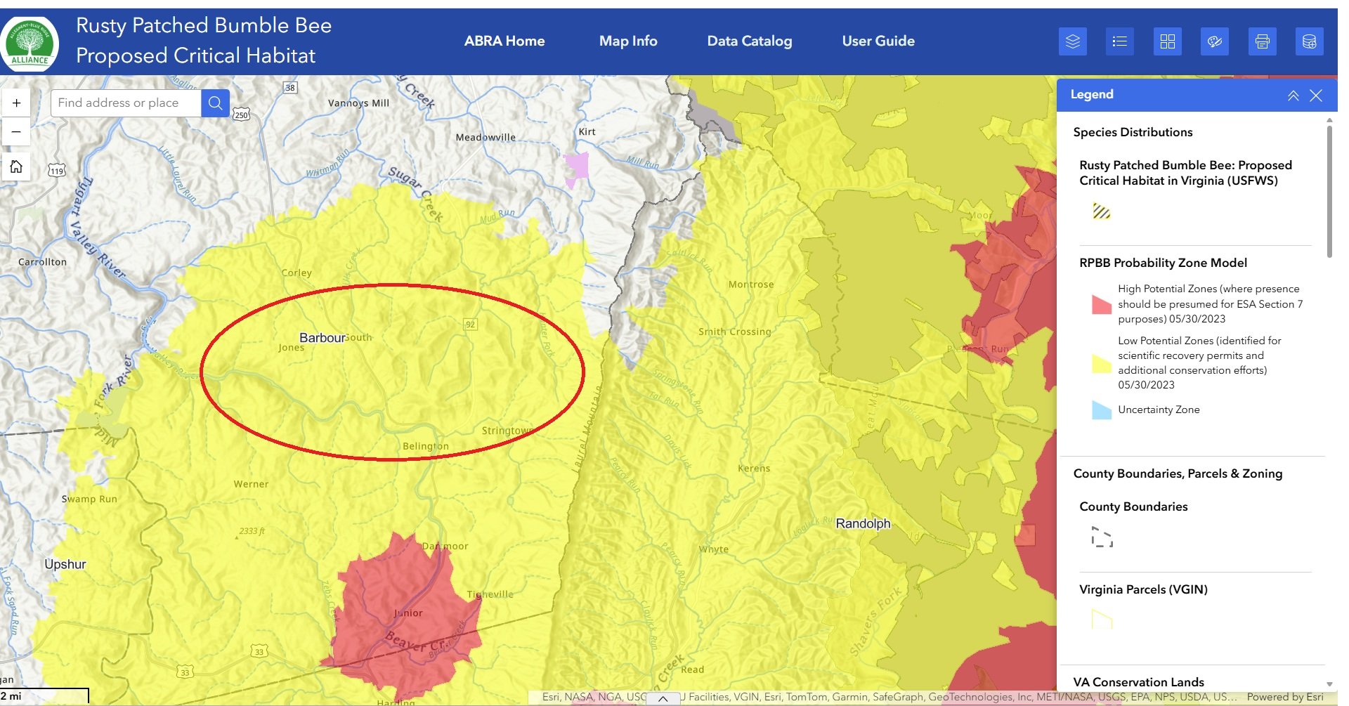
Map of the Rusty Patched Bumble Bee Critical Habitat as taken from the ARCGIS website. The entire yellow area is a buffer zone and the area within the red circle is Koontz Hollow and Hunter’s Fork, and the areas that both southern proposed routes of Valley North run through.
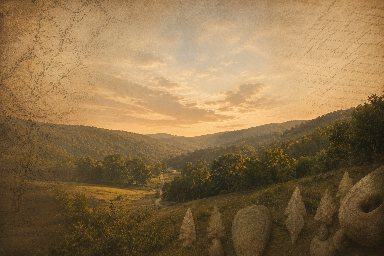
Historic Koontz Hollow and Hunter's Fork
The communities of Koontz Hollow and nearby Hunter's Fork occupy a distinctive part of West Virginia's rural landscape. Generations of families have lived, worked, farmed, hunted, and cared for these lands. The area's history reflects the broader story of Appalachian settlement, land stewardship, and community resilience.
This website serves as a repository for photographs, historical records, family histories, maps, and community documentation intended to preserve that legacy for future generations.