Property Impacts ~ Where the Water Begins
How engineering decisions on the surrounding ridges could affect groundwater, agriculture, drainage, and daily life on one generational 200 year old farm, while simultaneously affecting the entire hollow. This is why ridgetop construction deserves careful consideration. It is a case of power company Wealth vs Water.
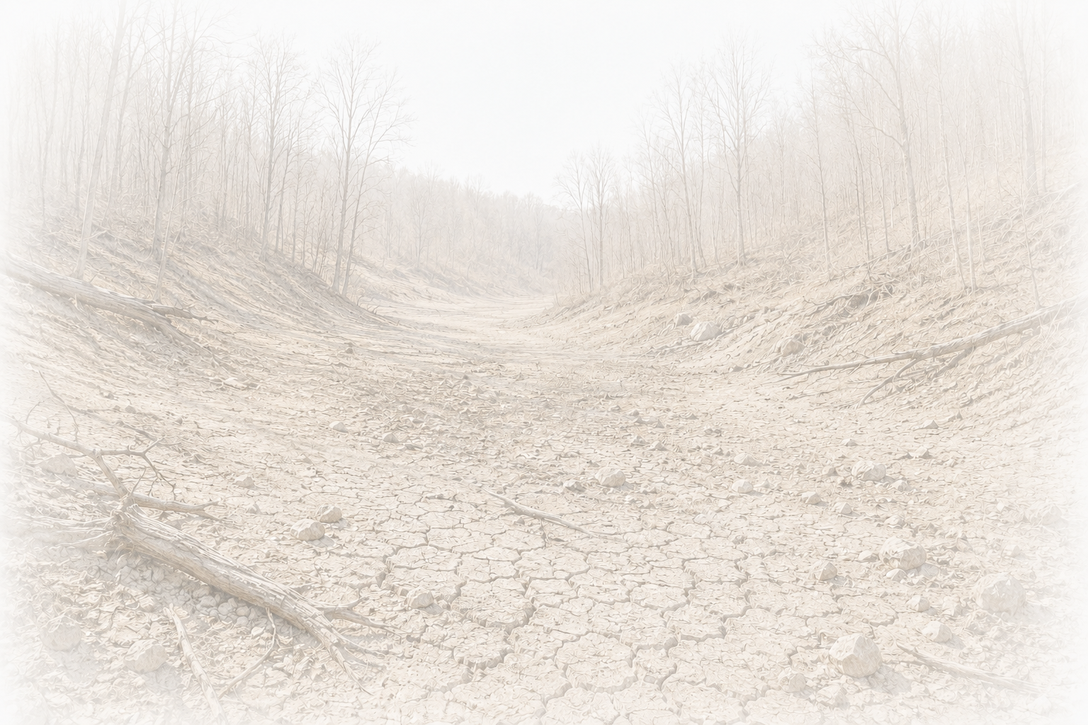
The creator of this website, whose Koontz ancestors are depicted on the Historic Koontz Hollow home page, has provided photographs documenting the current water conditions affecting one of the family properties located along the proposed Koontz Hollow - Kelley Road Valley Link corridor. These conditions exist today and may be further exacerbated if construction activities proceed along Koontz Hollow Ridge and into Hunter's Fork.
The topographic map below illustrates the location of the remaining spring-fed water source originating from the ridgeline down to the property. This spring contributes to the water supply for the property, feeds into ponds and streams joining the headwaters of Sugar Creek and represents the last remaining viable source of household water available to the homestead.
Water sources in this property already exhibit significant mineral staining, leaving orange deposits on plumbing fixtures, toilets, water bowls, storage containers, and other household surfaces even after treatment. While the family has adapted to these existing conditions while searching for a solution, the continued availability of the water source remains critical to the long-term habitability of the property.
Unlike municipal water systems, rural Appalachian homesteads often depend upon localized springs and groundwater resources that cannot be replaced if damaged or disrupted. Any impacts to the spring, groundwater recharge area, or associated hydrological systems could have consequences extending beyond temporary construction activities.
For this property, the spring is not simply a convenience—it is the last remaining viable water source supporting continued residential use of the farm. The loss or degradation of that resource would raise serious concerns regarding the future habitability of the homestead and the continued use of the property as a working farm within Historic Koontz Hollow and possibly the tributaries feeding into Sugar Creek. feeding cattle and other livestock.
The Last Remaining Water Source ~ When the Water is Gone
A farm water supply already under strain could face additional risk if the Valley Link corridor proceeds along Koontz Hollow Ridge and into Hunter's Fork.
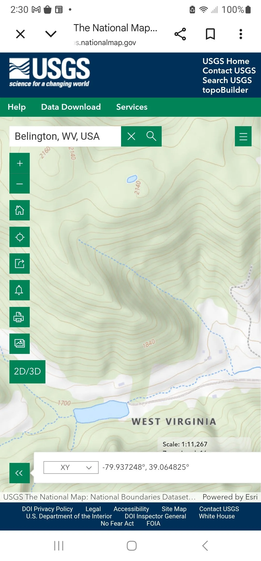
Topographic Map of Spring System and Ridgeline Water Source for 622 Kelley Road
This map illustrates the location where a spring originating higher on Koontz Hollow Ridge emerges at the surface before continuing downslope toward ponds, streams, and tributaries feeding the greater Sugar Creek watershed. During portions of the year, sections of the spring flow may disappear beneath rock formations before reemerging farther downslope.
The spring is part of a larger groundwater system that originates beneath the ridgeline and contributes to water resources supporting nearby farms, livestock, headwater tributaries, and residential use. Previous transmission proposals, including the former PATH corridor, would have crossed portions of this spring system. The currently proposed Valley Link corridor raises similar concerns regarding potential impacts to groundwater recharge areas, spring flow, and the originating water source located higher on the ridge.
Because this spring represents a critical component of the local water supply network, landowners have expressed concern regarding any activities that could affect the long-term integrity of the groundwater system, including the spring's point of origin, recharge areas, and downstream flow paths.
The water sources on the lower part of the property are no longer viable even after treatement, as can be seen from the photos below.
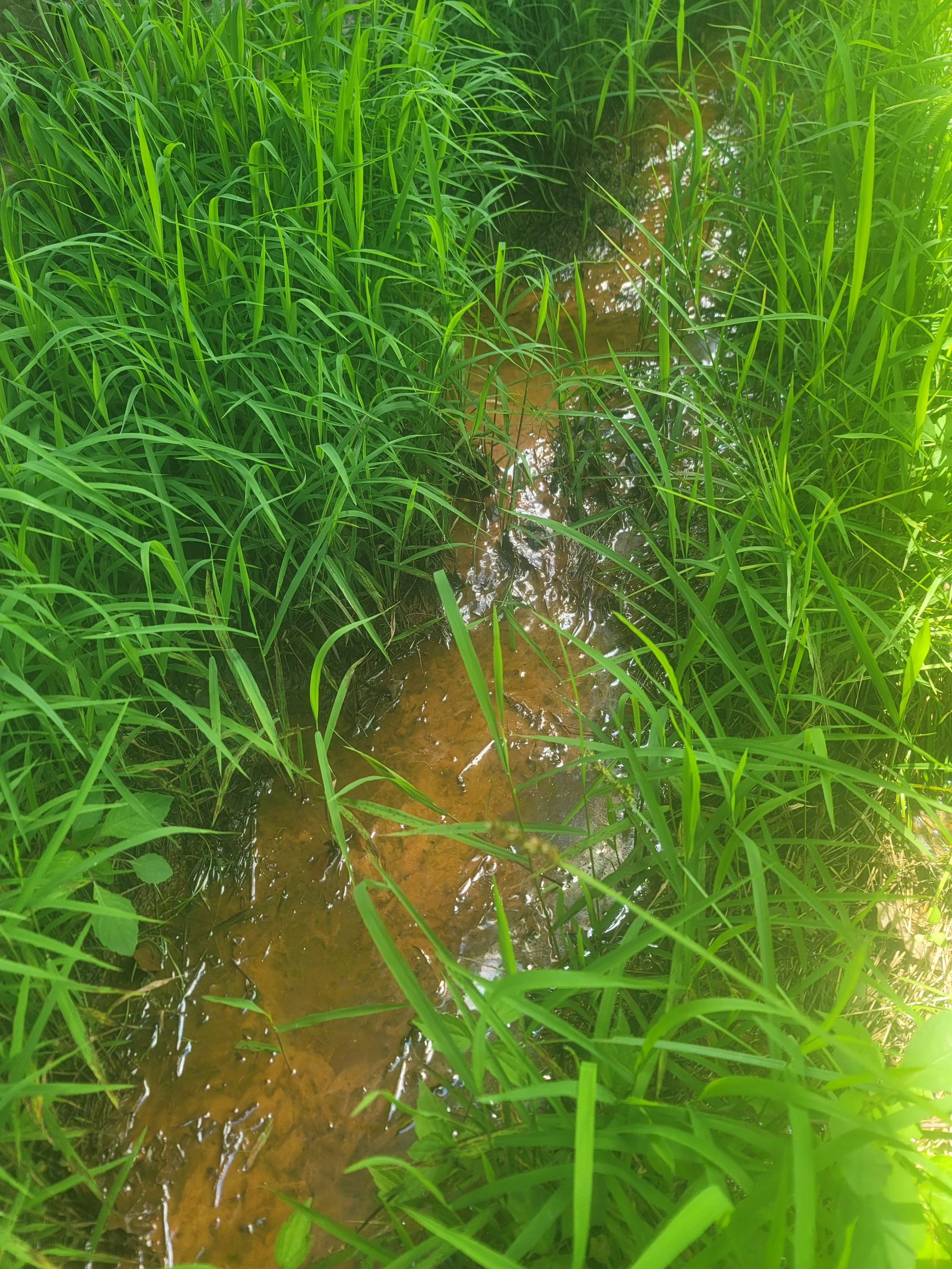
Water emerging from the table surrounding the house and from same supply that feeds the house - untreated. Existing water conditions at a Koontz Hollow homestead. Iron and mineral deposits leave significant staining on household fixtures and containers despite treatment measures. This property additionally has severe drainage issues.
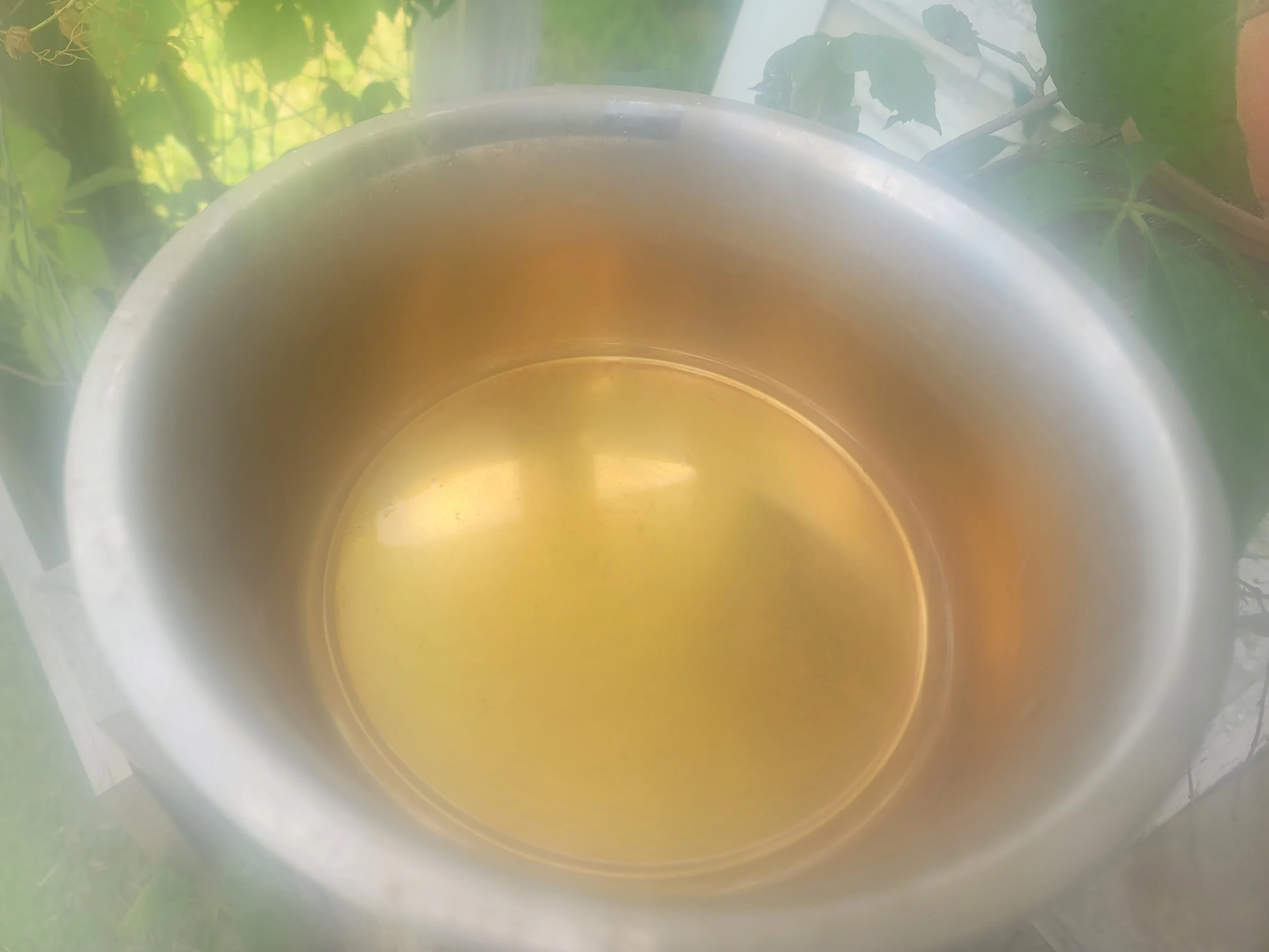
Dog bowl after holding TREATED water

Tank holding TREATED water

Plastic container stained orange after holding TREATED water
For this property, the spring is not simply a convenience—it is the last remaining viable water source supporting continued residential use of the farm. Previous efforts to improve water quality through treatment systems and other corrective measures have not fully resolved the underlying issues associated with the existing water supply. As a result, the residents planned to rely upon the remaining spring-fed source originating from Koontz Hollow Ridge as the most dependable long-term water solution for the property.
Any impacts to that spring, its recharge area, or the broader groundwater system associated with the proposed Valley Link corridor could raise serious concerns regarding the future habitability of the homestead and the continued viability of a family farm that has remained continuously owned and stewarded by the same family for more than 200 years within Historic Koontz Hollow.
The underground springs on this farm are sustained by a fragile groundwater system typical of the Appalachian Mountains, where water moves through fractured bedrock and, in some areas, limestone or other naturally fractured geologic formations before emerging as springs along the hillside. Construction of a 765-kV transmission corridor—including extensive tree clearing, excavation, drilling deep tower foundations, and the operation of heavy construction equipment—has the potential to intercept or alter these natural groundwater flow paths. Any disruption to this interconnected subsurface system could reduce or redirect spring flow, affecting the farm's primary water source, the downstream agricultural ponds they supply, and the headwater streams that ultimately feed Sugar Creek. Increased erosion and sediment generated during construction could further degrade water quality downstream, affecting aquatic habitat and the broader watershed beyond the boundaries of the property.
Uphill Construction, Downhill Consequences
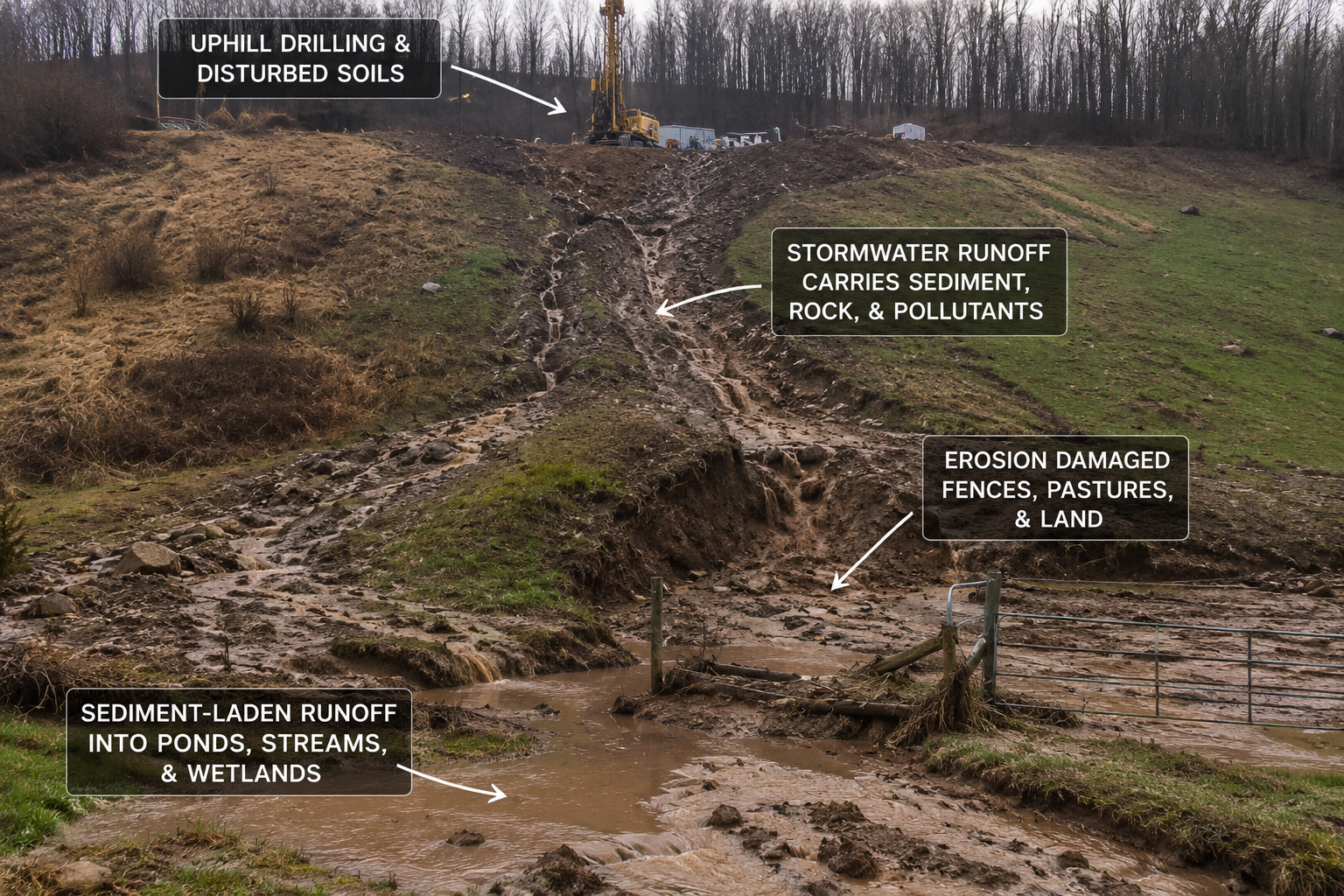
This farm already experiences drainage challenges resulting from historic strip mining that altered the natural movement of water across the landscape. The proposed construction of a 765-kV transmission corridor on the steep ridge directly above would introduce additional tree clearing, heavy equipment, deep foundation drilling, and permanent access roads into the very area that supplies the farm's remaining spring-fed water sources. Disturbance of these headwaters has the potential to reduce groundwater recharge while increasing downhill runoff, erosion, and sedimentation—threatening not only the last remaining sources of clean water, but also the long-term productivity and stability of the farmland itself.
What do you do when your water is threatened, politicians turn their head due to money, and Valley Link Transmission fails on multiple levels? What do you do when out of state entities require power due to poor planning on their part and when you have a corrupt conglomeration of power companies on the other end? What do you do when the water is gone?
The proposed fallback segment of the Valley North Project would require construction of multiple 765-kV transmission towers along the steep mountain ridge directly overlooking our lower-lying agricultural farm. This property already experiences drainage challenges resulting from historic strip mining activities. Constructing another major infrastructure corridor on the ridge above introduces the potential for additional hydrologic impacts that could further alter stormwater movement, increase erosion, and worsen flooding conditions within the valley below.
Downhill Runoff and Soil Compaction
Construction of 765-kV transmission towers requires extensive ridge-top development, including excavation, deep tower foundations, gravel access roads, drilling equipment, cranes, concrete trucks, and other heavy construction machinery. The repeated movement of this equipment across steep mountain slopes can compact soils, reducing their natural ability to absorb rainfall.
Healthy forest soils act like a sponge, allowing precipitation to infiltrate slowly into the ground where it recharges groundwater and feeds springs. When soils become compacted, significantly less water infiltrates the ground. Instead, rainfall is converted into rapid surface runoff that flows downhill at greater speed and volume. On steep Appalachian slopes, this increased runoff has the potential to intensify flooding, overwhelm existing drainage systems, and carry sediment directly onto lower-lying agricultural land.
Erosion and Sedimentation
Construction of a permanent transmission right-of-way also requires removal of the mature forest canopy, understory vegetation, and extensive root systems that naturally stabilize mountain soils. Without this natural erosion control, heavy rainfall can transport significant amounts of soil, mud, and construction sediment downhill.
For a farm already experiencing drainage challenges, additional sediment can clog drainage ditches, reduce their capacity to carry stormwater, increase the frequency and duration of field flooding, bury productive agricultural soils, and accelerate the filling of ponds with sediment. The same runoff ultimately enters the headwater streams and Sugar Creek, where excessive sediment can degrade aquatic habitat, destabilize streambanks, and bury the rocky streambed that supports aquatic insects forming the foundation of the freshwater food chain.
The concern is not limited to construction on the ridge itself. On steep Appalachian terrain, water, sediment, and erosion move downhill. Activities occurring hundreds of feet above the valley floor have the potential to influence the agricultural land, springs, streams, and watershed below long after construction has been completed.