Artifacts, Culture and Preservation
Exploring the cultural heritage, historical landscapes,, and archaeological significance of Koontz Hollow and nearby Hunter’s Fork.
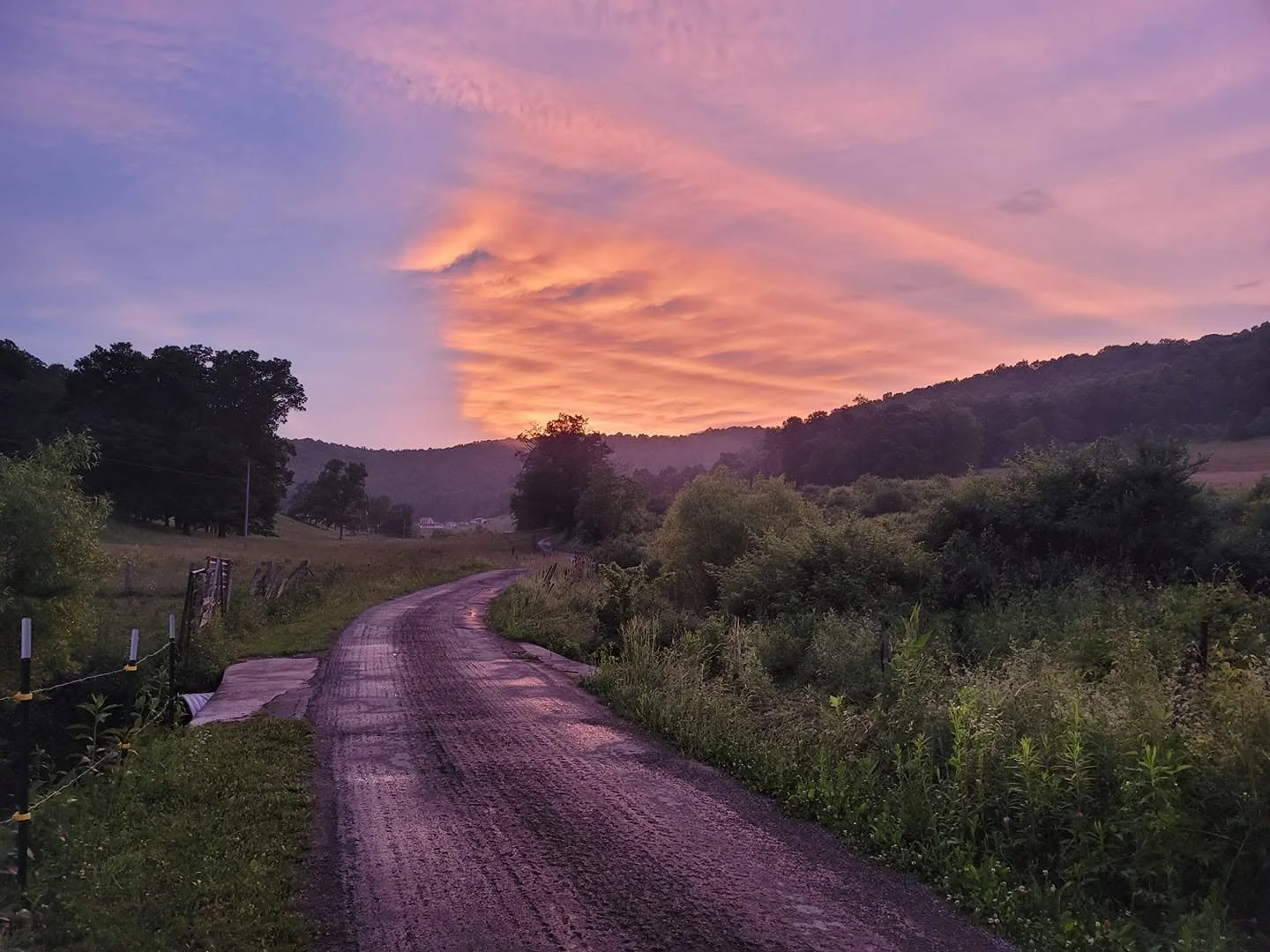
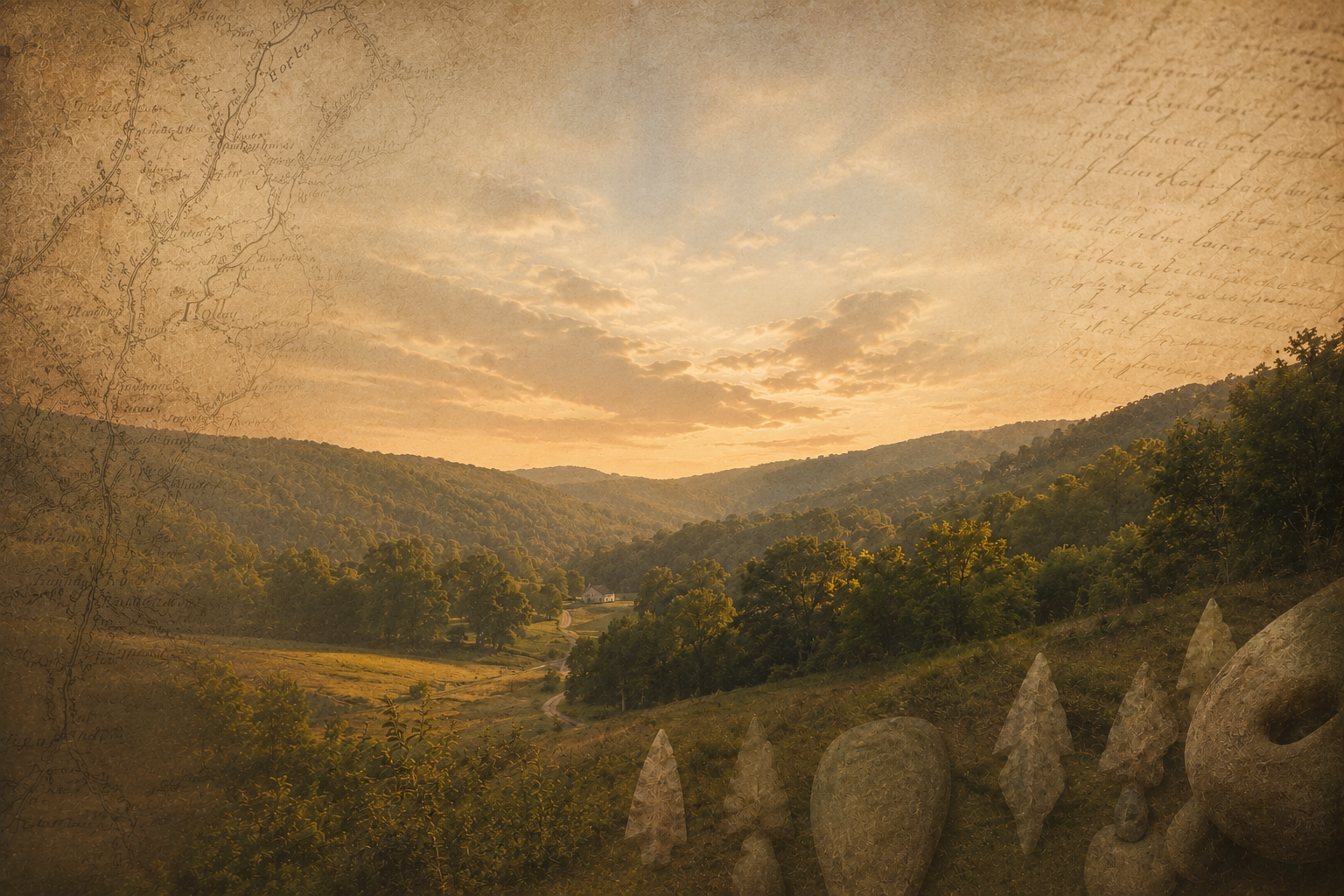
Koontz Hollow at sunset along Kelley Road. The ridge in the background holds traces of Eastern Woodland presence and is part of the landscape that people throughout time have called home. The ridge would potentially be scarred by the Valley North high voltage transmission line.
Cultural and Archaeological Significance
The region contains evidence of long-term human activity extending far beyond modern settlement. Eastern Woodland Native artifacts discovered within the area contribute to the understanding of the region's cultural history and underscore the importance of preserving archaeological and historical resources.
As additional research and documentation become available, this site will continue to provide information regarding the cultural significance of Koontz Hollow and surrounding areas.
Cultural Resources and Eastern Woodland Heritage
Koontz Hollow and the surrounding region are part of a landscape shaped not only by generations of family stewardship, but also by a much older human history. Artifacts discovered within the area, including prehistoric Eastern Woodland projectile points and a nutting stone, reflect the presence and activities of Indigenous peoples who lived, traveled, hunted, and gathered throughout these Appalachian hills long before European settlement.
The cultural story of the region is not confined to the past. Natural processes such as freeze-thaw cycles, erosion, and soil movement can periodically expose artifacts that have remained hidden for generations. As a result, the archaeological record continues to emerge over time, offering new opportunities to better understand the people who once occupied and utilized these landscapes.
Part of the conservation effort in Koontz Hollow involves not only the preservation and restoration of forests, wildlife habitat, and watersheds, but also the protection of cultural memory. Conserving the landscape helps preserve the historical context in which these artifacts are found and honors the legacy of the Eastern Woodland peoples whose connection to this region predates modern settlement by centuries.
The preservation of historic farms, forests, ridgelines, and archaeological resources contributes to a more complete understanding of the human history of Koontz Hollow and nearby Hunter's Fork.

Prehistoric Eastern Woodland projectile points discovered in Koontz Hollow and reflecting centuries of Indigenous presence.
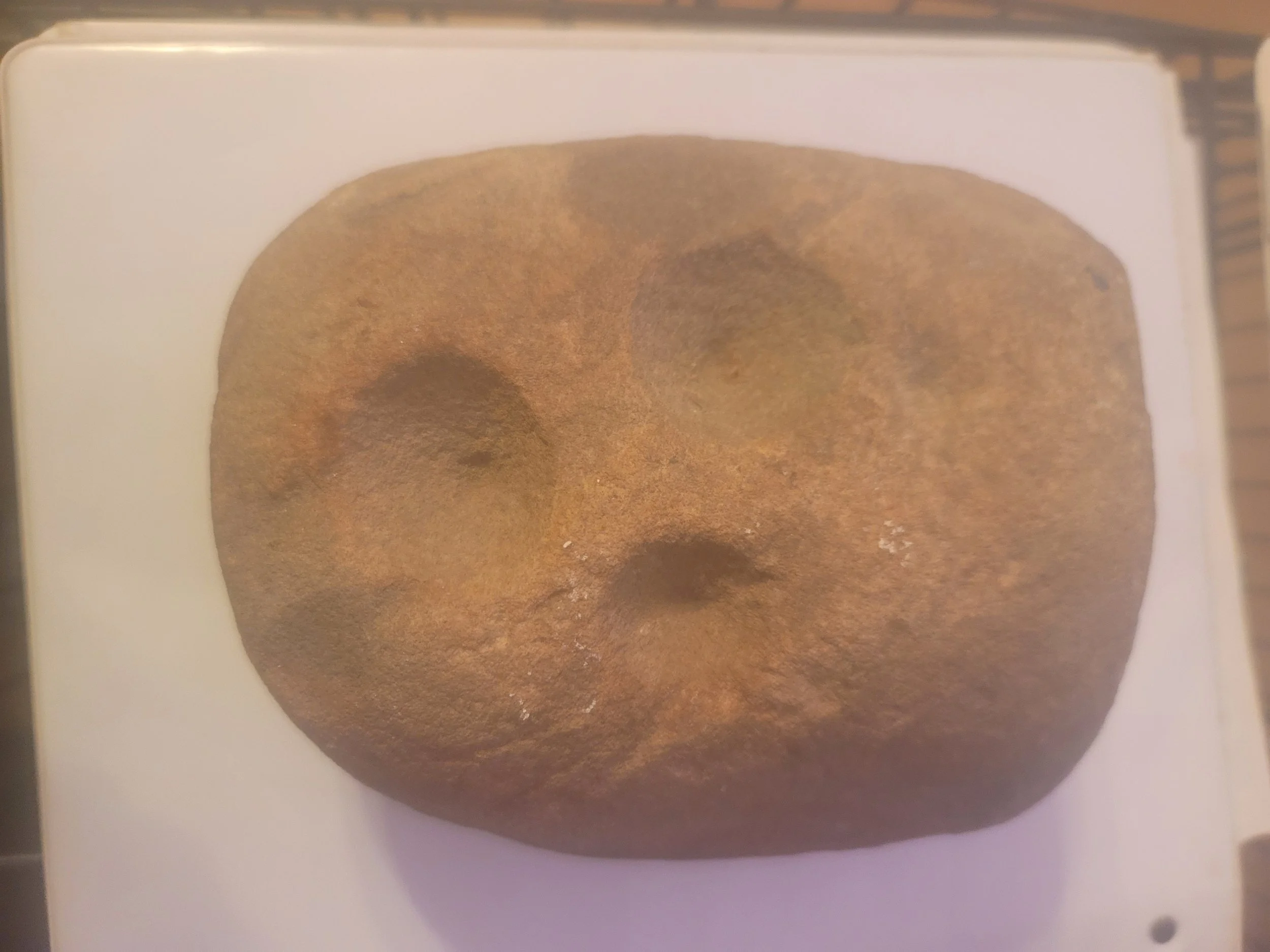
Prehistoric nutting stone used for food processing by Indigenous peoples of the Eastern Woodland tradition.

A Landscape Recognized Through Time
Long before modern maps, aerial photography, and digital surveys, early residents, travelers, and historians documented the character of Barbour County through written descriptions and hand-drawn maps. These records provide a glimpse into how the region was understood by those who first settled and explored it.
Historic maps reveal a landscape defined by ridgelines, streams, hollows, farms, and small communities connected by winding roads and natural features. While methods of mapping have changed dramatically over time, many of the same landmarks remain recognizable today.
The historic descriptions and maps presented here help preserve the cultural memory of Koontz Hollow, Hunter's Fork, and the surrounding area. They offer valuable insight into the development of the region and serve as a reminder that these landscapes have long been regarded as places of both practical importance and enduring beauty.
Together with family histories, archaeological resources, historic photographs, and preserved landscapes, these records contribute to a richer understanding of the heritage of Barbour County and the communities that continue to call it home.
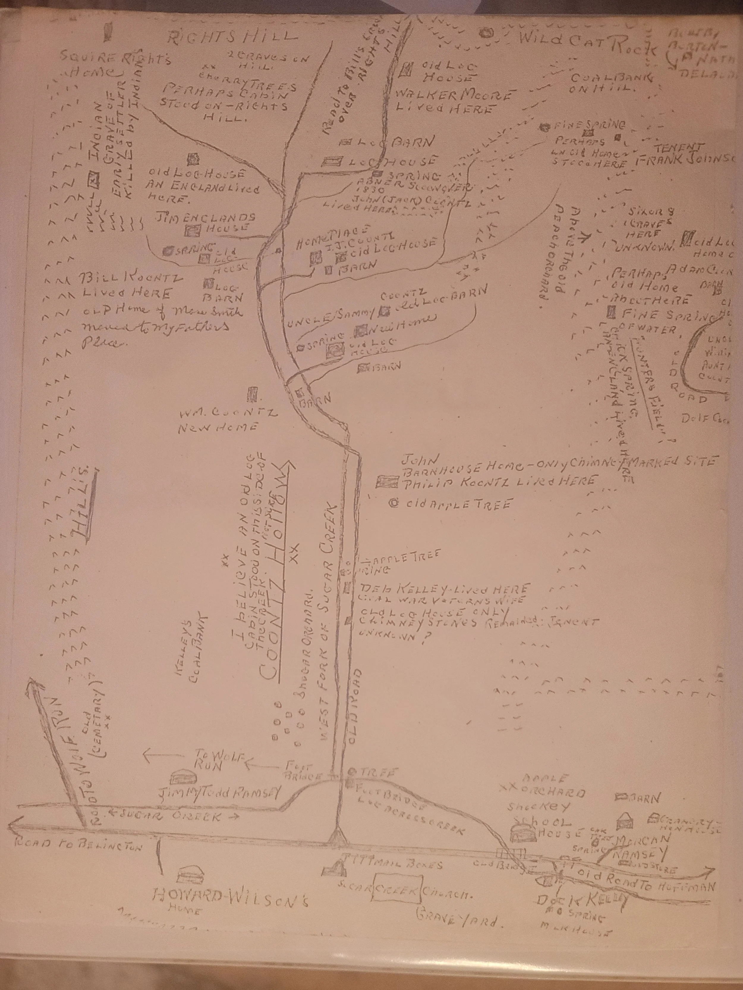
Hand drawn map by ancestor recalling Koontz Hollow Settlements of the mid to late 1800s
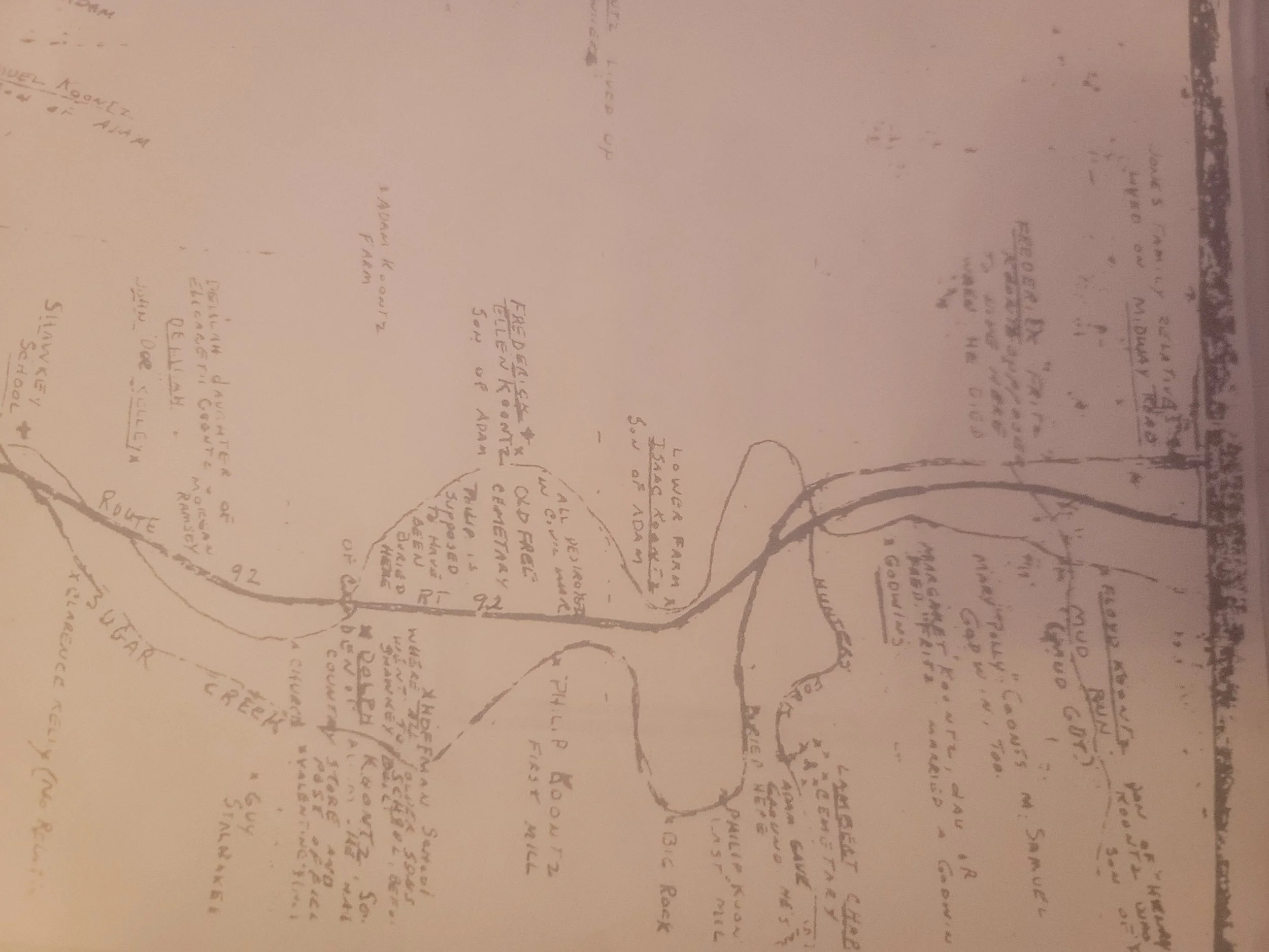
Hand drawn map by ancestor recalling Koontz Hollow, Sugar Creek and Hunter’s Fork settlements of the early to late 1800s.
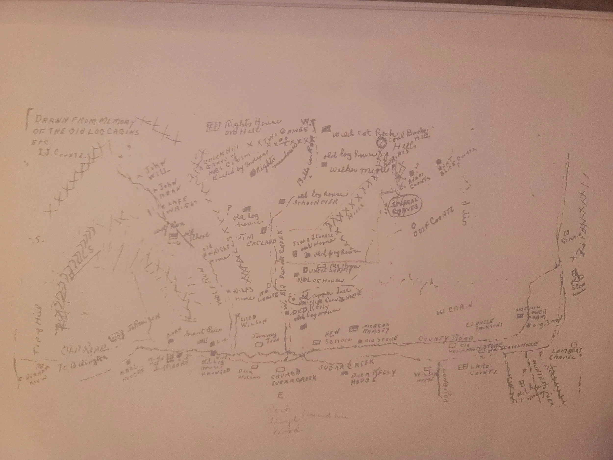
Hand drawn map by ancestor recalling Koontz Hollow, Wolf Run, Shockey and Hunter’s Fork settlements of the early to late 1800s.
A Living Landscape
The farms, forests, streams, and ridgelines of Koontz Hollow are part of an intentionally managed landscape shaped by generations of stewardship. While some portions of the area remain in active agricultural use, other wooded areas are being deliberately preserved in their natural condition.
These forests should not be viewed as vacant, unused, or lower-impact land. They provide wildlife habitat, watershed protection, soil stability, privacy, natural regeneration, and long-term restoration of family property. In many cases, allowing land to return to forest is itself a conscious land-management decision that reflects conservation and stewardship goals developed over generations.
As discussions regarding the proposed Valley North and Valley Link transmission projects continue, it is important to recognize that wooded portions of affected properties represent an intentional and valuable land use—not simply open space available for development or routing.

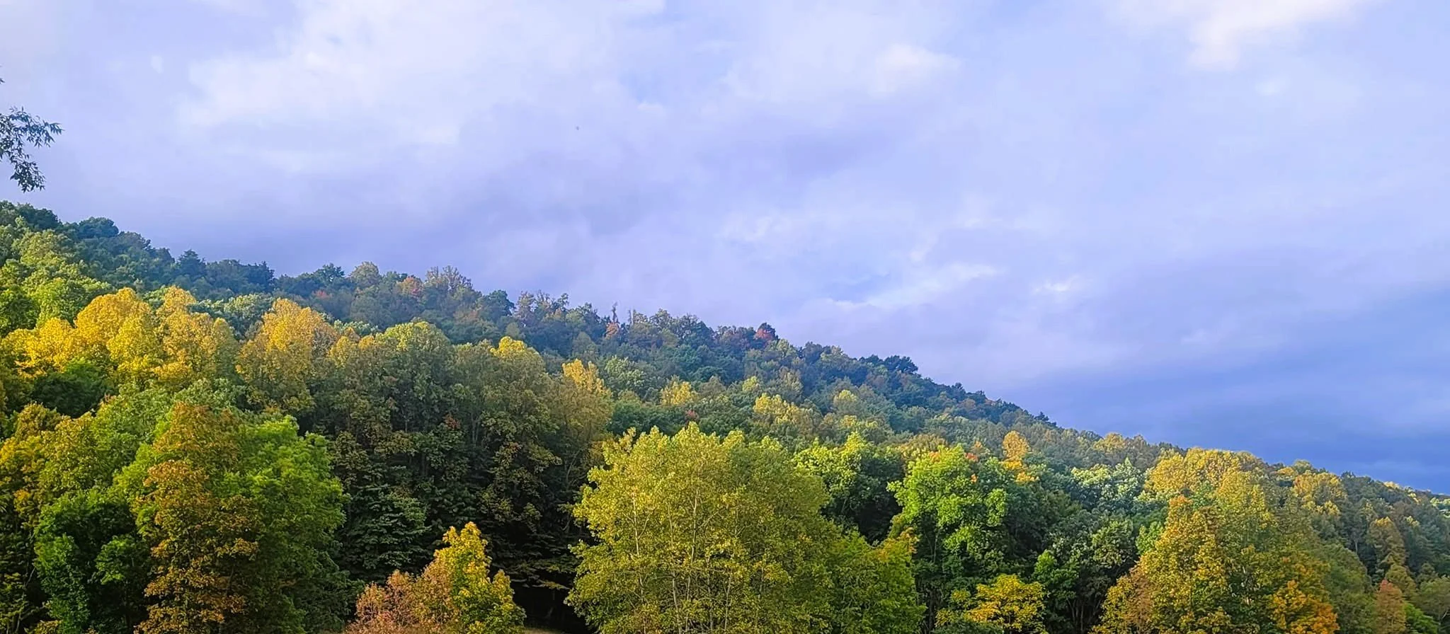
Ridge behind Koontz Homestead that has intentionally not been timbered for carbon offset forestry and that holds the last remaining viable source of water. This same ridge would have been destroyed by the Potomac Appalachian Transmission Highline and now Valley North. The wooded area also holds graves, foundations from older settlements and Eastern Woodland artifacts.
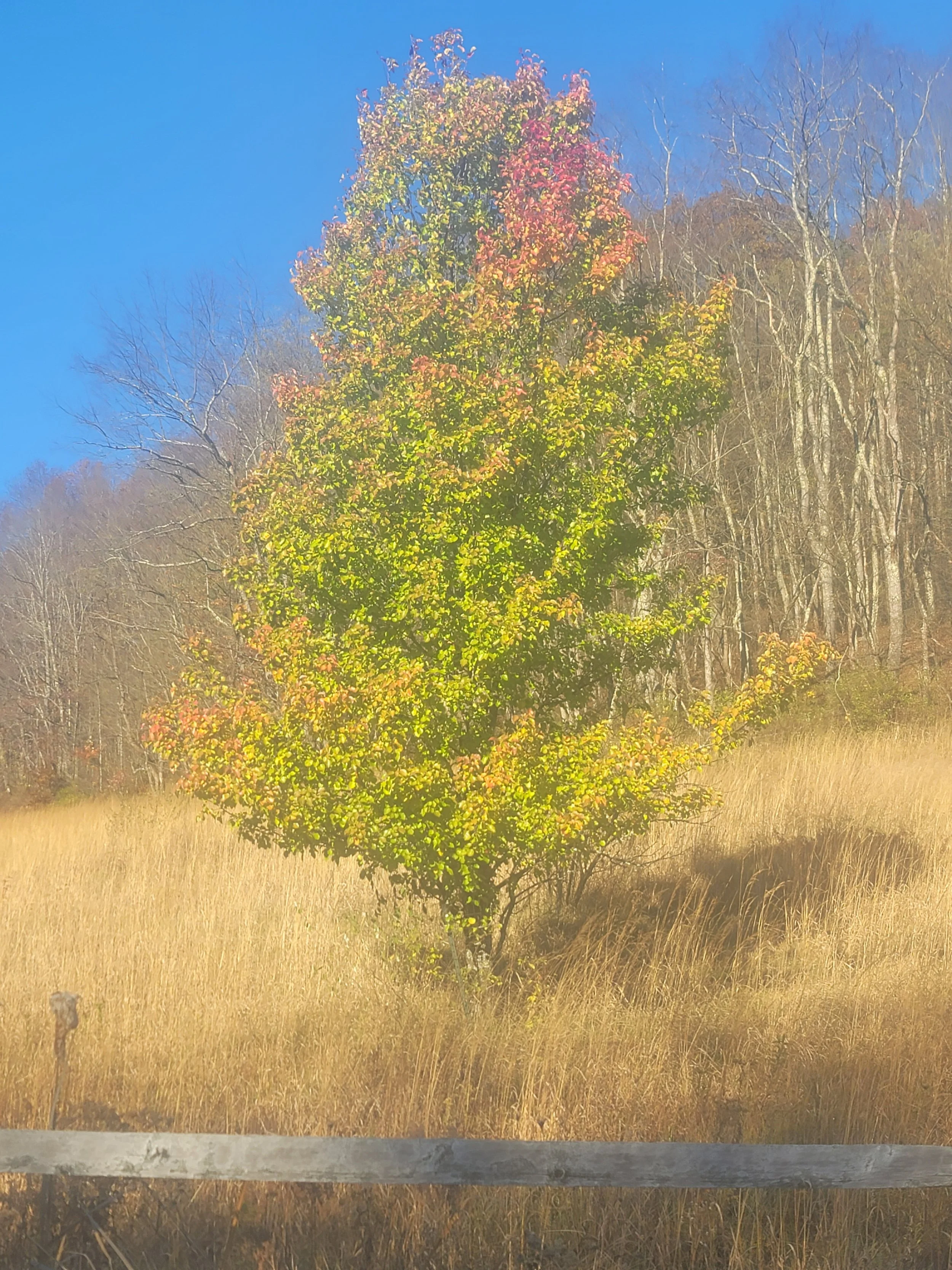
Trees planted to stabilize the slopes and to increase wooded area
Historic Koontz Hollow and Hunter's Fork
The communities of Koontz Hollow and nearby Hunter's Fork occupy a distinctive part of West Virginia's rural landscape. Generations of families have lived, worked, farmed, hunted, and cared for these lands. The area's history reflects the broader story of Appalachian settlement, land stewardship, and community resilience.
This website serves as a repository for photographs, historical records, family histories, maps, and community documentation intended to preserve that legacy for future generations.